Spring 2025

View as a list →

almerimar - los escullos

Logbook

  • Departure: Almerimar (36.6771, -2.6737), Monday, April 21, 2025 at 19:04 UTC
  • Arrival: Los Escullos (36.8046, -2.0589), Tuesday, April 22, 2025 at 11:12 UTC
  • Duration: 16.1 h
  • Distance: 39.9 nm
  • Average speed: 2.5 kn
  • Crew: Tobi, Anna, Jo, Eli

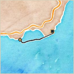
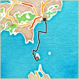
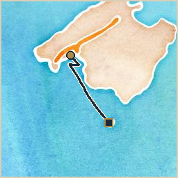
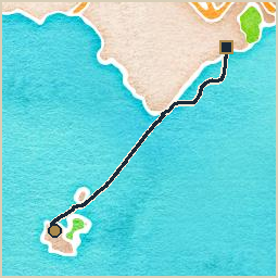
Weighed anchor at Almerimar, bound for Los Escullos: a long day that ran past sunset covering 40 nautical miles at an average of 2.5 knots. Wind 0–8 kn from the WSW, gusting to 18 kn. Current up to 1.4 kn setting ENE. The autopilot packed in early on, so the whole leg was hand-steered. Worth it, though: the anchorage at Los Escullos, in front of an old fort, was a fine reward.

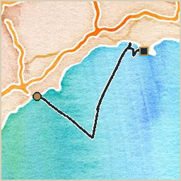
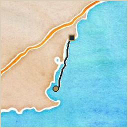
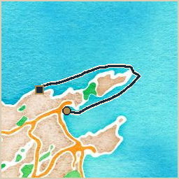
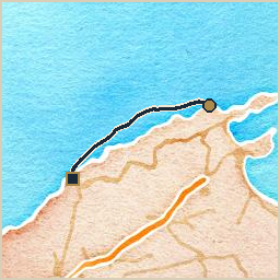
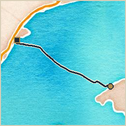
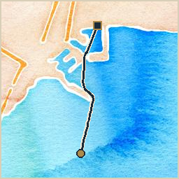
Watercolor-style map of the route from Almerimar to Los Escullos: a navy track line with a gold circle marking the start and a dark square marking the end

on a helmsman's first resignation

The autopilot quit within hours of leaving Almerímar, which meant a whole overnight leg to Los Escullos steered by hand, in the dark, by a crew who had rather hoped to be doing other things with their evening. I did not have a name for this sort of behavior yet. I have one now. At the time I simply stood over the tiller, unseen as usual, and watched a perfectly good electronic helmsman give up the moment the work started, which strikes me as a fairly reliable definition of cowardice in any century.

I will say this much in its defense: at least it had the decency to fail early, before the wind picked up, rather than waiting for the worst possible moment to make its point. That refinement, I gather, came later.

Someone at the tiller all night is proper old-fashioned sailing, the kind I was built for, and I stayed close the whole way in, which is more than the autopilot managed. The anchorage at Los Escullos, in front of its old fort, was a fine reward for it. A long night, a tired crew, and a good hook down at the end. I have seen worse trades.

los escullos - carboneras

Logbook

  • Departure: Los Escullos (36.8030, -2.0564), Wednesday, April 23, 2025 at 09:34 UTC
  • Arrival: Carboneras (36.9896, -1.8984), Wednesday, April 23, 2025 at 19:54 UTC
  • Duration: 10.3 h
  • Distance: 28.8 nm
  • Average speed: 2.8 kn
  • Crew: Tobi, Anna, Jo, Eli

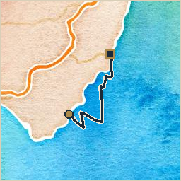
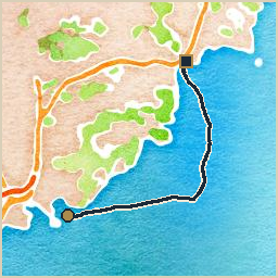
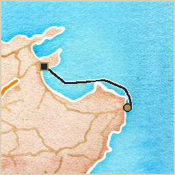
Departed Los Escullos for Carboneras, a full day underway covering 29 nautical miles at 2.8 knots average. Wind 6–9 kn from the ENE, gusting to 19 kn. Current up to 0.5 kn setting WSW. The “marina” at Carboneras turned out to be a rickety pier with questionable electricity and, in the low season no less, an eye-watering 50€ a night.

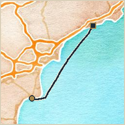
Watercolor-style map of the route from Los Escullos to Carboneras: a navy track line with a gold circle marking the start and a dark square marking the end

carboneras - garrucha

Logbook

  • Departure: Carboneras (36.9913, -1.8895), Friday, April 25, 2025 at 09:48 UTC
  • Arrival: Garrucha (37.1845, -1.8193), Friday, April 25, 2025 at 14:51 UTC
  • Duration: 5.1 h
  • Distance: 14.3 nm
  • Average speed: 2.8 kn
  • Crew: Tobi, Anna, Jo, Eli

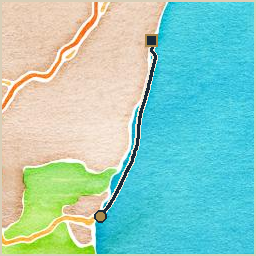
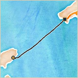
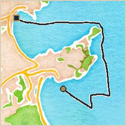
Carboneras to Garrucha: a modest half-day’s sail, 14 nautical miles at an average of 2.8 knots. Wind 4–8 kn from the SSE, gusting to 20 kn. The seafood restaurants at the harbor were excellent, though a gypsum shipping facility right by the marina keeps everything coated in a fine layer of dust.

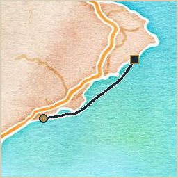
Watercolor-style map of the route from Carboneras to Garrucha: a navy track line with a gold circle marking the start and a dark square marking the end

garrucha - águilas

Logbook

  • Departure: Garrucha (37.1766, -1.8144), Sunday, April 27, 2025 at 11:41 UTC
  • Arrival: Águilas (37.4034, -1.5709), Sunday, April 27, 2025 at 20:15 UTC
  • Duration: 8.6 h
  • Distance: 22.5 nm
  • Average speed: 2.6 kn
  • Crew: Tobi, Anna, Jo, Eli

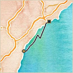
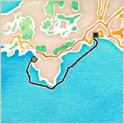
Cast off from Garrucha bound for Águilas: a full day underway, 22 nautical miles at an average of 2.6 knots. Wind 6–10 kn from the E, gusting to 20 kn. It backed from SE to ENE. Nice sailing throughout, capped off with a quiet anchorage in the bay of Águilas.

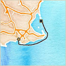
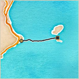
Watercolor-style map of the route from Garrucha to Águilas: a navy track line with a gold circle marking the start and a dark square marking the end

águilas - cala cerrada

Logbook

  • Departure: Águilas (37.4014, -1.5689), Monday, April 28, 2025 at 07:57 UTC
  • Arrival: Cala Cerrada (37.5410, -1.1541), Monday, April 28, 2025 at 18:43 UTC
  • Duration: 10.8 h
  • Distance: 39.2 nm
  • Average speed: 3.6 kn
  • Crew: Tobi, Anna, Jo, Eli

Departed Águilas for Cala Cerrada, a full day underway covering 39 nautical miles at 3.6 knots average. Wind 7–13 kn from the E, gusting to 25 kn. Seas up to 0.8m. Current up to 0.8 kn setting NNE. With bad weather building on the horizon, we sought shelter in this tiny, well-protected cove, picking up one of its two mooring balls, and ended up staying three nights before conditions were calm enough to press on to Cartagena. The generator got its first real workout on day two. On the first day Tobi and Jo took the dinghy ashore to explore the beach and a small cave, with Jo running around spotting wild flowers and Tobi on photography duty for Anna.

Watercolor-style map of the route from Águilas to Cala Cerrada: a navy track line with a gold circle marking the start and a dark square marking the end

cala cerrada - cala cerrada

Logbook

  • Departure: Cala Cerrada (37.5372, -1.1515), Tuesday, April 29, 2025 at 10:57 UTC
  • Arrival: Cala Cerrada (37.5385, -1.1544), Tuesday, April 29, 2025 at 11:59 UTC
  • Duration: 1.0 h
  • Distance: 1.5 nm
  • Average speed: 1.5 kn
  • Crew: Tobi, Anna, Jo, Eli

Weighed anchor at Cala Cerrada, bound for Cala Cerrada: a short hop covering 1 nautical miles at an average of 1.5 knots. Wind 15 kn from the ENE, gusting to 29 kn. Seas up to 1.3m. A first attempt to make a break for Cartagena turned back almost as soon as we left: the sea state outside the cove was too rough to continue, and back to the mooring ball we went.

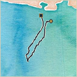
Watercolor-style map of the route from Cala Cerrada to Cala Cerrada: a navy track line with a gold circle marking the start and a dark square marking the end

cala cerrada - cartagena

Logbook

  • Departure: Cala Cerrada (37.5383, -1.1521), Thursday, May 1, 2025 at 09:33 UTC
  • Arrival: Cartagena (37.5943, -0.9787), Thursday, May 1, 2025 at 15:25 UTC
  • Duration: 5.9 h
  • Distance: 12.3 nm
  • Average speed: 2.1 kn
  • Crew: Tobi, Anna, Jo, Eli

Departed Cala Cerrada for Cartagena, a modest half-day’s sail covering 12 nautical miles at 2.1 knots average. Wind 7–11 kn from the ENE, gusting to 22 kn. Seas up to 1.2m. Entering Cartagena harbor was an impressive approach, and the berth and facilities at Yacht Port Cartagena didn’t disappoint: the whole family went exploring around the marina. Met George and Sinead aboard S/V Muhuhu, another fully electric sailboat, there.

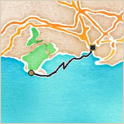
Watercolor-style map of the route from Cala Cerrada to Cartagena: a navy track line with a gold circle marking the start and a dark square marking the end

on three nights in a cove with two mooring balls

Bad weather building off Águilas sent us running for the nearest tiny, well-protected notch in the coast, which turned out to have exactly two mooring balls and, once we’d picked one up, absolutely nowhere else to be for three days. I do not mind being stuck somewhere. I have been stuck in worse places for considerably longer than three days. But I will note that a crew penned into a small cove with nothing to do develops its own kind of weather, and it is not always calmer than the kind outside.

The generator got its first proper workout on the second day, which I watched with some interest, having spent centuries relying on nothing grander than wind and a favor owed. Tobi and Jo went ashore to explore a cave and a scattering of wildflowers, Jo wanting to pick a bunch for his mother until Tobi talked him out of it: leave them where they are, take a photograph instead, and Anna gets to see them just the same without a single flower having to die for it. Jo took the job seriously after that, marching Tobi from bloom to bloom and directing exactly which ones deserved a picture. For a few hours the whole business of waiting out weather looked almost like a holiday rather than a delay.

On the morning we thought the wind had eased enough, we made a break for open water and lasted perhaps an hour before the sea outside made the decision for us and sent us straight back to the same mooring ball. I will admit to some quiet satisfaction at that. The sea rarely needs my help to make its point, but it is always gratifying to watch it prove one anyway.

cartagena - mar menor

Logbook

  • Departure: Cartagena (37.5929, -0.9809), Sunday, May 4, 2025 at 08:44 UTC
  • Arrival: Mar Menor (37.7469, -0.7422), Sunday, May 4, 2025 at 16:30 UTC
  • Duration: 7.8 h
  • Distance: 29.6 nm
  • Average speed: 3.8 kn
  • Crew: Tobi, Anna, Jo, Eli

Slipped the lines at Cartagena and pointed the bow toward Mar Menor, a modest half-day’s sail covering 30 nautical miles at an average of 3.8 knots. Wind 0–17 kn from the SSW, gusting to 34 kn. Seas up to 1.3m. The approach to the Mar Menor runs through a narrow, shallow canal under a bridge that only lifts once an hour. By the time we reached the western end of it, wind and sea state had picked up considerably, so rather than press on into the Mar Menor itself we tied up at Puerto Deportivo Tomás Maestre.

Watercolor-style map of the route from Cartagena to Mar Menor: a navy track line with a gold circle marking the start and a dark square marking the end

mar menor - santa pola

Logbook

  • Departure: Mar Menor (37.7471, -0.7397), Monday, May 5, 2025 at 09:59 UTC
  • Arrival: Santa Pola (38.1881, -0.5619), Monday, May 5, 2025 at 17:20 UTC
  • Duration: 7.3 h
  • Distance: 31.5 nm
  • Average speed: 4.3 kn
  • Crew: Tobi, Anna, Jo, Eli

Departed Mar Menor for Santa Pola, a modest half-day’s sail covering 32 nautical miles at 4.3 knots average. Wind 8–11 kn from the WSW, gusting to 24 kn. It backed from WNW to SSW. Seas up to 0.6m. Finally caught up with Siggi and Kati on S/V Kasibu here, to hand off a package we’d been carrying since Almerimar, and finally tracked down the proper odor-proof hose to fix the toilet.

Watercolor-style map of the route from Mar Menor to Santa Pola: a navy track line with a gold circle marking the start and a dark square marking the end

on paperwork, and a familiar face down from the hills

The marina office in La Vila Joiosa wanted a bank statement proving that an insurance premium had, in fact, been paid, which is not a request I have any patience for. I have watched harbors get built out of nothing more than a good beach and a rumor of shelter. I have watched them outlive the men who built them. Not one of those harbors ever asked to see paperwork first. Progress, apparently, means a form for everything, even the wind.

It came right eventually, as these things do, and the reward for sitting through it was better than the aggravation deserved: Stephan, from the very same sailing club back in Berlin as Tobi and Anna, drove down out of the mountains to meet us, exactly as arranged days in advance over whatever device it is the crew keeps whispering into at all hours. Not a fellow sailor pulling in on a matching flag. Just a friend with a car and a vacation house who kept his word.

I’ll admit that isn’t the kind of reunion I’m built for. A ship’s spirit expects his old acquaintances to arrive by water, and there is something faintly undignified about one turning up smelling of a rental car and mountain air instead of salt. Still, a friend who drives an hour down out of the hills to sit on a pontoon with you is worth something, wherever he keeps his boat. Which, it turns out, is Berlin. Landlocked loyalty. I didn’t expect to respect it quite as much as I do.

santa pola - la vila joiosa

Logbook

  • Departure: Santa Pola (38.1856, -0.5631), Thursday, May 8, 2025 at 08:53 UTC
  • Arrival: La Vila Joiosa (38.5064, -0.2199), Thursday, May 8, 2025 at 15:47 UTC
  • Duration: 6.9 h
  • Distance: 26.8 nm
  • Average speed: 3.9 kn
  • Crew: Tobi, Anna, Jo, Eli

Cast off from Santa Pola bound for La Vila Joiosa: a modest half-day’s sail, 27 nautical miles at an average of 3.9 knots. Wind 3–9 kn from the SE, gusting to 22 kn. Check-in at Club Nàutic La Vila Joiosa was a bizarrely bureaucratic affair, with the staff insisting on a bank statement proving insurance premiums had actually been paid. Met up with Stephan, a fellow member of the SC Gothia sailing club back in Berlin, who has a vacation home in the mountains nearby and drove down to see us, arranged in advance.

Watercolor-style map of the route from Santa Pola to La Vila Joiosa: a navy track line with a gold circle marking the start and a dark square marking the end

la vila joiosa - moraira

Logbook

  • Departure: La Vila Joiosa (38.5044, -0.2178), Friday, May 9, 2025 at 09:26 UTC
  • Arrival: Moraira (38.6855, 0.1441), Friday, May 9, 2025 at 16:24 UTC
  • Duration: 7.0 h
  • Distance: 21.2 nm
  • Average speed: 3.0 kn
  • Crew: Tobi, Anna, Jo, Eli

Weighed anchor at La Vila Joiosa, bound for Moraira: a modest half-day’s sail covering 21 nautical miles at an average of 3.0 knots. Wind 4–6 kn from the SSE, gusting to 16 kn. Seas up to 0.6m. Current up to 0.5 kn setting NNE. The anchorage in the bay of Moraira was a bit rolly, but the transit berth at Club Náutico Moraira more than made up for it.

Watercolor-style map of the route from La Vila Joiosa to Moraira: a navy track line with a gold circle marking the start and a dark square marking the end

moraira - s'espalmador

Logbook

  • Departure: Moraira (38.6855, 0.1383), Sunday, May 11, 2025 at 06:43 UTC
  • Arrival: S’Espalmador (38.7788, 1.4248), Monday, May 12, 2025 at 00:23 UTC
  • Duration: 17.7 h
  • Distance: 64.2 nm
  • Average speed: 3.6 kn
  • Crew: Tobi, Anna, Jo, Eli

Slipped the lines at Moraira and pointed the bow toward S’Espalmador, a long day that ran past sunset covering 64 nautical miles at an average of 3.6 knots. Wind 3–13 kn from the SW, gusting to 17 kn. It backed from NNW to WSW. Seas up to 0.7m. Current up to 0.7 kn setting E. The crossing to the Balearics: arrived in the middle of the night and dropped anchor by moonlight. Come morning, the anchorage turned out to be breathtaking, a great white-sand beach, and we ended up spending a long day there. Tobi and Jo took the dinghy over to Formentera to stock up on groceries and hunt down a replacement VHF antenna.

Watercolor-style map of the route from Moraira to S'Espalmador: a navy track line with a gold circle marking the start and a dark square marking the end

on moonlight, and a stolen outboard two boats over

We came into S’Espalmador in the small hours, dropping anchor by moonlight off a beach so white it seemed to glow on its own account, and I will admit that for a night or two this crossing to the Balearics felt like the kind of arrival a ship’s spirit remembers fondly for a century or so. Nobody in a hurry to leave. Water the color you don’t quite believe from photographs. Tobi and Jo off to Formentera for groceries and, memorably, a replacement VHF antenna, since apparently even radios fail out here and not only autopilots.

Cala Talamanca, a few days later, was a rather ruder welcome: a horribly rolly anchorage, and worse for our neighbors Siggi and Kati aboard Kasibu, whose outboard was lifted clean off the stern pushpit overnight while everyone slept. I take a dim view of theft at anchor. A harbor is meant to be a kind of truce, and whoever did the lifting broke it for every boat in the bay that night, not just the one they robbed.

I could not have stopped it. Invisible does not mean omniscient, and I was minding our own lines, not theirs. But I would have liked the chance to try.

s'espalmador - cala talamanca

Logbook

  • Departure: S’Espalmador (38.7776, 1.4223), Wednesday, May 14, 2025 at 12:43 UTC
  • Arrival: Cala Talamanca (38.9133, 1.4560), Wednesday, May 14, 2025 at 18:20 UTC
  • Duration: 5.6 h
  • Distance: 12.5 nm
  • Average speed: 2.2 kn
  • Crew: Tobi, Anna, Jo, Eli

S’Espalmador to Cala Talamanca: a modest half-day’s sail, 12 nautical miles at an average of 2.2 knots. Wind 5–8 kn from the E, gusting to 20 kn. Picking a path through the sandbanks between Ibiza and Formentera took some care, and Cala Talamanca itself turned out to be horribly rolly. Siggi and Kati weren’t so lucky either: their outboard was stolen right off the stern pushpit.

Watercolor-style map of the route from S'Espalmador to Cala Talamanca: a navy track line with a gold circle marking the start and a dark square marking the end

cala talamanca - santa eulària

Logbook

  • Departure: Cala Talamanca (38.9087, 1.4644), Thursday, May 15, 2025 at 12:46 UTC
  • Arrival: Santa Eulària (38.9848, 1.5393), Thursday, May 15, 2025 at 16:51 UTC
  • Duration: 4.1 h
  • Distance: 9.7 nm
  • Average speed: 2.4 kn
  • Crew: Tobi, Anna, Jo, Eli

Left Cala Talamanca and made for Santa Eulària, a modest half-day’s sail covering 10 nautical miles at an average of 2.4 knots. Wind 5–7 kn from the N, gusting to 16 kn. Seas up to 0.7m. Spotted dolphins in the distance on the way in, a nice surprise. The marina at Santa Eulària has some shallow patches, and we found at least one of them the hard way, stuck briefly in the mud. The town itself is every bit as “Ibiza” as you’d expect, expensive restaurants and bars included.

Watercolor-style map of the route from Cala Talamanca to Santa Eulària: a navy track line with a gold circle marking the start and a dark square marking the end

santa eulària - santa ponça

Logbook

  • Departure: Santa Eulària (38.9822, 1.5385), Saturday, May 17, 2025 at 09:50 UTC
  • Arrival: Santa Ponça (39.5157, 2.4675), Sunday, May 18, 2025 at 01:30 UTC
  • Duration: 15.7 h
  • Distance: 56.0 nm
  • Average speed: 3.6 kn
  • Crew: Tobi, Anna, Jo, Eli

Departed Santa Eulària for Santa Ponça, a long day that ran past sunset covering 56 nautical miles at 3.6 knots average. Wind 7–10 kn from the SSE, gusting to 13 kn. Seas up to 0.6m. Another arrival after dark, dropping anchor in Santa Ponça well into the night.

Watercolor-style map of the route from Santa Eulària to Santa Ponça: a navy track line with a gold circle marking the start and a dark square marking the end

santa ponça - palma de mallorca

Logbook

  • Departure: Santa Ponça (39.5142, 2.4647), Monday, May 19, 2025 at 09:18 UTC
  • Arrival: Palma de Mallorca (39.5674, 2.6379), Monday, May 19, 2025 at 15:58 UTC
  • Duration: 6.7 h
  • Distance: 17.3 nm
  • Average speed: 2.6 kn
  • Crew: Tobi, Anna, Jo, Eli, Hendrik

Cast off from Santa Ponça bound for Palma de Mallorca: a modest half-day’s sail, 17 nautical miles at an average of 2.6 knots. Wind 1–9 kn from the S, gusting to 27 kn. It veered from ESE to SW. Hendrik joined the crew in Santa Ponça for this leg, picked up by dinghy, before we sailed around the western tip of Mallorca and into the bay of Palma. Landed a guest berth at the Real Club Náutico de Palma, reasonably priced, and the facilities were great. Our old dinghy chose today to enter a state of rapid unscheduled self-disassembly, so we picked up a new (used) one here; the old one got wrapped up and lashed to the stern pushpit rather than left behind, and rode along with us the rest of the way home.

Watercolor-style map of the route from Santa Ponça to Palma de Mallorca: a navy track line with a gold circle marking the start and a dark square marking the end

on retirement, and rapid unscheduled self-disassembly

Hendrik came aboard today, ferried out to the boat by dinghy, which would be an unremarkable way to start a story except that the dinghy in question chose that same window of time to finish falling apart. The logbook is calling it a state of rapid unscheduled self-disassembly. I call it a dinghy with poor timing and worse judgment about when to make a scene.

There was no replacement waiting, of course. That is not how any of this works, whatever the crew likes to pretend after the fact. A dinghy falls apart, and only then does anyone start looking for a new one. A guest berth in Palma meant nobody needed to swim for it in the meantime, at least, but the next anchorages down the coast would not be so accommodating, so the search still happened in something of a hurry. A new, used dinghy came aboard within a few days.

The old one did not go wherever old dinghies go. Nobody could quite bring themselves to leave it on a foreign dock, so it got wrapped into a sorry sort of bundle and lashed to the stern pushpit, where, as far as I know, it is riding still, all the way back to La Ràpita and however much further this crew intends to drag it. I find I approve. A proper burial is one thing. Hauling the deceased along for the rest of the voyage rather than admit defeat is, historically speaking, exactly the kind of stubbornness a ship’s spirit respects.

on checkered history, and needing a permit to anchor

Cabrera wanted a cruising permit and a paid mooring reservation before it would have us, which amused me more than it should have, given the island’s own history includes rather less orderly chapters: a military garrison, a notorious prison camp, centuries of being fought over by people who never once filled out a form about it first. Now it is a nature reserve, and the only thing being fought over is a mooring buoy, and you need paperwork to lose that fight too. I suppose that is what passes for progress.

The night skies here are the clearest this crew has seen all season, clear enough that Hendrik went ashore after dark with a camera to photograph the Milky Way, and I will say the island earns its reputation on that count if nothing else. A place with a history this checkered ought to at least have the decency to look peaceful once the sun goes down, and it does.

I spent the evening on deck, unseen, doing the thing I am actually built for: keeping half an eye on the boat while everyone else looked up instead of down. Somebody has to.

palma de mallorca - port de cabrera

Logbook

  • Departure: Palma de Mallorca (39.5607, 2.6320), Wednesday, May 21, 2025 at 09:15 UTC
  • Arrival: Port de Cabrera (39.1473, 2.9325), Wednesday, May 21, 2025 at 19:31 UTC
  • Duration: 10.3 h
  • Distance: 34.7 nm
  • Average speed: 3.4 kn
  • Crew: Tobi, Anna, Jo, Eli, Hendrik

Set a course from Palma de Mallorca to Port de Cabrera: a full day underway, 35 nautical miles at an average of 3.4 knots. Needed a cruising permit before setting off, plus a paid reservation for a mooring buoy in the natural harbor. Cabrera is the main island of the Illes de Cabrera, a nature reserve with a checkered history. Spent a couple of beach days there; Hendrik went ashore at night to photograph the Milky Way.

Watercolor-style map of the route from Palma de Mallorca to Port de Cabrera: a navy track line with a gold circle marking the start and a dark square marking the end

port de cabrera - cala santanyí / cala llombards

Logbook

  • Departure: Port de Cabrera (39.1495, 2.9305), Friday, May 23, 2025 at 12:23 UTC
  • Arrival: Cala Santanyí / Cala Llombards (39.3287, 3.1475), Friday, May 23, 2025 at 19:09 UTC
  • Duration: 6.8 h
  • Distance: 16.7 nm
  • Average speed: 2.5 kn
  • Crew: Tobi, Anna, Jo, Eli, Hendrik

Slipped the lines at Port de Cabrera and pointed the bow toward Cala Santanyí / Cala Llombards, a modest half-day’s sail covering 17 nautical miles at an average of 2.5 knots. Wind 2–8 kn from the WSW, gusting to 15 kn. It backed from NE to W. Seas up to 0.6m. Wind and waves were not exactly friendly. Anchoring in Cala Santanyí was interesting, wedged between two steep cliffs about 60 meters apart. Hendrik left the boat here, and we moved on to Cala Llombards, where we spent an afternoon exploring caves by dinghy.

Watercolor-style map of the route from Port de Cabrera to Cala Santanyí / Cala Llombards: a navy track line with a gold circle marking the start and a dark square marking the end

cala santanyí / cala llombards - porto cristo

Logbook

  • Departure: Cala Santanyí / Cala Llombards (39.3233, 3.1445), Sunday, May 25, 2025 at 11:25 UTC
  • Arrival: Porto Cristo (39.5389, 3.3377), Sunday, May 25, 2025 at 16:05 UTC
  • Duration: 4.7 h
  • Distance: 17.6 nm
  • Average speed: 3.8 kn
  • Crew: Tobi, Anna, Jo, Eli

Left Cala Santanyí / Cala Llombards and made for Porto Cristo, a modest half-day’s sail covering 18 nautical miles at an average of 3.8 knots. Wind 11–12 kn from the SW, gusting to 26 kn. Back to a crew of four after Hendrik’s departure. In Porto Cristo we visited the Cuevas del Drach, an impressive network of underground caves hung with stalagmites and stalactites, and met Bine and Peter aboard S/V JOY.

Watercolor-style map of the route from Cala Santanyí / Cala Llombards to Porto Cristo: a navy track line with a gold circle marking the start and a dark square marking the end

on small feet, and a companionway conquered

I have watched a great many things go wrong on a great many boats, and I generally consider myself hard to surprise. Eli surprised me today. Not yet one year old, not walking properly on land as far as I’ve seen, and he hauled himself up the companionway steps today, one small determined hand over the other, entirely on his own. Jo went up first, found Tobi at the tiller the way he always does, and came back down again, and Eli, who had watched every step of it from the cabin sole, decided his turn had come.

Nobody taught him that climb, not directly. I was belowdecks and saw the whole thing: no hesitation, no crying for help, just a baby who had clearly filed away his brother’s ascent a minute earlier and concluded the technique would work for him too. He got to the top, found Tobi at the tiller, and grinned like he’d just crossed an ocean. In a sense he had.

I have minded the comings and goings of a great many crews over a great many centuries, and I will say this plainly: I did not expect a one-year-old to out-climb half the able seamen I’ve known. Land-walking can apparently wait. A boat teaches its own priorities first.

porto cristo - cala ratjada

Logbook

  • Departure: Porto Cristo (39.5370, 3.3401), Tuesday, May 27, 2025 at 10:31 UTC
  • Arrival: Cala Ratjada (39.7080, 3.4627), Tuesday, May 27, 2025 at 16:29 UTC
  • Duration: 6.0 h
  • Distance: 14.1 nm
  • Average speed: 2.4 kn
  • Crew: Tobi, Anna, Jo, Eli

Slipped the lines at Porto Cristo and pointed the bow toward Cala Ratjada, a modest half-day’s sail covering 14 nautical miles at an average of 2.4 knots. Wind 5–7 kn from the ESE, gusting to 17 kn. It veered from E to SE. The transit berths in the communal harbor sit directly across the water from bars and clubs blasting bad party music all night. Not a fan.

Watercolor-style map of the route from Porto Cristo to Cala Ratjada: a navy track line with a gold circle marking the start and a dark square marking the end

cala ratjada - alcúdia

Logbook

  • Departure: Cala Ratjada (39.7080, 3.4658), Wednesday, May 28, 2025 at 10:22 UTC
  • Arrival: Alcúdia (39.8341, 3.1309), Wednesday, May 28, 2025 at 17:14 UTC
  • Duration: 6.9 h
  • Distance: 21.1 nm
  • Average speed: 3.1 kn
  • Crew: Tobi, Anna, Jo, Eli

Departed Cala Ratjada for Alcúdia, a modest half-day’s sail covering 21 nautical miles at 3.1 knots average. Wind 3–5 kn from the E, gusting to 14 kn. It veered from NNE to E. Anchored overnight outside the harbor entrance in the bay of Alcúdia.

Watercolor-style map of the route from Cala Ratjada to Alcúdia: a navy track line with a gold circle marking the start and a dark square marking the end

alcúdia - port de pollença

Logbook

  • Departure: Alcúdia (39.8262, 3.1504), Thursday, May 29, 2025 at 10:32 UTC
  • Arrival: Port de Pollença (39.9023, 3.0852), Thursday, May 29, 2025 at 16:22 UTC
  • Duration: 5.8 h
  • Distance: 15.0 nm
  • Average speed: 2.6 kn
  • Crew: Tobi, Anna, Jo, Eli

Departed Alcúdia for Port de Pollença, a modest half-day’s sail covering 15 nautical miles at 2.6 knots average. Wind 3–5 kn from the NE, gusting to 13 kn. It veered from N to ESE. Loved Port de Pollença: a very nice communal harbor, great playgrounds and beaches for the kids, and a huge anchorage outside the breakwater. Every morning the local air force base’s firefighting waterplane did its rounds overhead. Also joined the Young Cruisers Association’s “Floatchella Mallorca” event here alongside half a dozen other boats, good fun for everybody.

Watercolor-style map of the route from Alcúdia to Port de Pollença: a navy track line with a gold circle marking the start and a dark square marking the end

port de pollença - cala castell

Logbook

  • Departure: Port de Pollença (39.9012, 3.0883), Wednesday, June 4, 2025 at 12:35 UTC
  • Arrival: Cala Castell (39.9334, 3.0347), Wednesday, June 4, 2025 at 19:43 UTC
  • Duration: 7.1 h
  • Distance: 17.7 nm
  • Average speed: 2.5 kn
  • Crew: Tobi, riot

Cast off from Port de Pollença bound for Cala Castell: a modest half-day’s sail, 18 nautical miles at an average of 2.5 knots. Wind 1–5 kn from the NNE, gusting to 16 kn. It veered from NNW to ENE. Current up to 0.6 kn setting E. Anna, Jo, and Eli left the boat in Port de Pollença, and riot came aboard to sail on with Tobi. On the way back toward the mainland, we just anchored overnight in Cala Castell before pressing on to Port de Sóller the next day.

Watercolor-style map of the route from Port de Pollença to Cala Castell: a navy track line with a gold circle marking the start and a dark square marking the end

cala castell - port de sóller

Logbook

  • Departure: Cala Castell (39.9359, 3.0344), Thursday, June 5, 2025 at 07:28 UTC
  • Arrival: Port de Sóller (39.7948, 2.6917), Thursday, June 5, 2025 at 17:40 UTC
  • Duration: 10.2 h
  • Distance: 20.5 nm
  • Average speed: 2.0 kn
  • Crew: Tobi, riot

Slipped the lines at Cala Castell and pointed the bow toward Port de Sóller, a full day underway covering 20 nautical miles at an average of 2.0 knots. Wind 1–3 kn from the NNE, gusting to 12 kn. Current up to 0.5 kn setting ENE. Port de Sóller is the only protected, safe harbor on Mallorca’s north coast, and our last stop before heading back over to the mainland.

Watercolor-style map of the route from Cala Castell to Port de Sóller: a navy track line with a gold circle marking the start and a dark square marking the end

port de sóller - sant carles de la ràpita

Logbook

  • Departure: Port de Sóller (39.7962, 2.6889), Saturday, June 7, 2025 at 11:00 UTC
  • Arrival: Sant Carles de la Ràpita (40.5904, 0.6013), Monday, June 9, 2025 at 03:25 UTC
  • Duration: 40.4 h
  • Distance: 117.2 nm
  • Average speed: 2.9 kn
  • Crew: Tobi, riot

Cast off from Port de Sóller bound for Sant Carles de la Ràpita: an overnight passage of roughly 1.7 days, 117 nautical miles at an average of 2.9 knots. Wind 2–15 kn from the E, gusting to 21 kn. It backed from SSE to E. Seas up to 1.3m. Current up to 0.5 kn setting WSW. Quite significant waves for parts of the crossing, but all in all a pleasurable non-stop passage back to the mainland, ending at anchor overnight off Punta de la Banya before moving into the marina the next morning. In a few days Tinarasia comes out of the water for at least half a year. There’s no shortage of items on the refit to-do list.

Watercolor-style map of the route from Port de Sóller to Sant Carles de la Ràpita: a navy track line with a gold circle marking the start and a dark square marking the end

sant carles de la ràpita - sant carles marina

Logbook

  • Departure: Sant Carles de la Ràpita (40.5989, 0.6022), Monday, June 9, 2025 at 12:23 UTC
  • Arrival: Sant Carles Marina (40.6228, 0.6063), Monday, June 9, 2025 at 13:08 UTC
  • Duration: 0.7 h
  • Distance: 1.6 nm
  • Average speed: 2.2 kn
  • Crew: Tobi, riot

Set a course from Sant Carles de la Ràpita to Sant Carles Marina: a short hop, 2 nautical miles at an average of 2.2 knots. Wind 8 kn from the SSE, gusting to 17 kn. The short move from anchor off Punta de la Banya into the marina, and the last leg of the Spring 2025 season. Tinarasia would be hauled out for a long refit shortly after.

Watercolor-style map of the route from Sant Carles de la Ràpita to Sant Carles Marina: a navy track line with a gold circle marking the start and a dark square marking the end

a first season's accounting

Seven weeks ago this crew slipped their lines in Almerímar with two small children aboard, Jo two years old and Eli not yet one, and no idea yet what this boat would ask of them. Tonight she is back in her home berth on the Ebro Delta, and I have had the whole final crossing to think about what I’ve learned in my first season aboard a boat that groans considerably less than the ones I’m used to.

Anna, Jo, and Eli flew home from Port de Pollença before the last stretch, and riot came aboard in their place for the run back along Mallorca’s north coast, which is the oldest rhythm there is on a boat like this one: crew comes, crew goes, and somebody has to be there for all of it regardless of who’s aboard on any given week. That has always been my job. I did not expect to mind the coming and going quite so much this time.

A hand-steered night to Los Escullos. Three nights trapped in a cove with two mooring balls. A stolen outboard I couldn’t prevent, a dinghy that fell apart out of spite and never actually left us, lashed to the stern the rest of the way home, and skies over Cabrera clear enough to make the whole business worth it. Now she comes out of the water for a long refit, and I am told there is talk of more solar, a proper electric galley, and less use for a generator that has, by my count, earned its retirement fairly. I will believe the rest of it when I see it. I usually do.

spring 2025: a season in review

Seven weeks ago, S/V Tinarasia slipped her lines in Almerímar, on the Costa del Sol, with Tobi, Anna, and two small kids aboard (Jo two years old, Eli not yet one) and pointed her bow east. Tonight she’s back in her home berth at Sant Carles Marina, on the Ebro Delta, with a long refit list waiting and the crew roster having turned over twice along the way. In between: a hand-steered overnight passage, three nights sheltering from weather in a cove with exactly two mooring balls, an overnight crossing to the Balearics that ended by moonlight, a stolen outboard, a nature reserve with a checkered military history, and a fair amount of very good anchoring.

A rough start off the Costa del Sol

The season opened badly, in the specific way that sailing seasons like to open badly: the autopilot died within hours of leaving Almerímar, and the whole overnight leg to Los Escullos had to be hand-steered. It was worth it: the anchorage at Los Escullos, in front of an old fort, was a fine reward at the end of a long night. From there the coast turned into a string of short, occasionally trying hops. A “marina” at Carboneras turned out to be a rickety pier with dubious electricity and an eye-watering fifty euros a night, in the low season no less. A gypsum shipping facility at Garrucha kept the whole boat coated in fine white dust between excellent seafood dinners at the harborside restaurants.

Then the weather actually turned nasty. Running from building conditions off Águilas, Tinarasia found Cala Cerrada (a tiny, well-protected notch in the coast with exactly two mooring balls) and ended up staying three nights while the sea outside built into something nobody wanted to cross. On the second day, with Jo ashore spotting wildflowers and Tobi on photography duty for Anna, the generator got its first real workout of the season. A first attempt to break out toward Cartagena the next morning lasted about an hour: the moment the bow cleared the cove, the sea state outside made the decision for them, and it was back to the mooring ball. Two days later, with the wind finally down, the actual crossing to Cartagena took less than six hours.

Up the coast, port by port

Cartagena was a high point early on: an impressive harbor entrance, a proper marina at Yacht Port Cartagena, and a meeting with George and Sinead aboard S/V Muhuhu, another fully electric sailboat and, as it turned out, kindred spirits. From there the coast turned into a string of half-day hops: through the narrow, shallow canal into the edge of the Mar Menor, with a bridge that only lifts once an hour, and conditions building fast enough by the time they reached it that the plan changed to tying up at Puerto Deportivo Tomás Maestre instead of pushing into the lagoon itself. On to Santa Pola, where a package that had been riding along since Almerímar finally reached its owners, Siggi and Kati aboard S/V Kasibu, and the boat’s long-suffering toilet finally got the proper odor-proof hose it had been needing for weeks. La Vila Joiosa delivered a small dose of Spanish bureaucracy (a marina office insisting on a bank statement proving insurance premiums had actually cleared) and, more happily, a prearranged meetup with Stephan from SC Gothia, Tobi’s own sailing club back in Berlin, who drove down from his vacation home in the nearby mountains as promised. Moraira rounded out the run with a slightly rolly anchorage redeemed by a good transit berth at the Club Náutic.

Crossing to the Balearics

The crossing itself came next, an overnight run from Moraira that ended in the small hours with Tinarasia dropping anchor off S’Espalmador by moonlight. Morning revealed one of the best anchorages of the whole season: a great white-sand beach, water the color you only half-believe from the photos, and a day good enough that nobody was in a hurry to leave. Tobi and Jo took the dinghy across to Formentera for groceries and, memorably, a replacement VHF antenna. Threading the sandbanks between Ibiza and Formentera into Cala Talamanca took some care and delivered a horribly rolly night at anchor for the trouble: Siggi and Kati, anchored nearby, had it worse, waking up to find their outboard stolen straight off the stern pushpit. Santa Eulària brought dolphins on the approach and a brief, undignified grounding in a shallow patch of the marina, worked free without drama; the town itself lived up to every Ibiza cliché, bars and restaurant prices included.

Mallorca, a change of crew, and Cabrera

An overnight passage brought the boat to Mallorca and an arrival at Santa Ponça well after dark, followed by a short hop around the island’s western tip into Palma. Hendrik joined the crew here, ferried out to the boat by dinghy, and the old dinghy itself gave out on the spot (the logbook dryly called it “a state of rapid unscheduled self-disassembly”), forcing a scramble for a newly acquired used one; rather than leave the wreck behind, the crew wrapped it up and lashed it to the stern pushpit, and it rode along all the way home to La Ràpita. From Palma, Cabrera: a nature reserve with a cruising-permit requirement, a paid mooring reservation, a checkered military history, and clear enough night skies that Hendrik went ashore after dark to photograph the Milky Way. Cala Santanyí offered an anchorage wedged dramatically between cliffs sixty meters apart before Hendrik’s own passage ended and the family carried on alone to Cala Llombards, exploring sea caves by dinghy in the afternoon light.

Porto Cristo brought the Cuevas del Drach (an underground cave system strung with stalactites and stalagmites) and a meeting with Bine and Peter aboard S/V JOY. Cala Ratjada’s communal harbor turned out to sit directly across the water from a strip of bars blasting music most of the night, not a fan favorite. Alcúdia and Port de Pollença followed at a gentler pace: a good anchorage outside the breakwater at Alcúdia, and at Pollença a small daily ritual of watching the local air base’s firefighting seaplane make its rounds overhead, excellent playgrounds for the kids, and a spontaneous “Floatchella Mallorca” gathering with half a dozen other boats from the Young Cruisers Association.

The last stretch, singlehanded-ish, back to the mainland

Port de Pollença also marked a turning point in the crew roster: Anna, Jo, and Eli flew home, and riot came aboard to sail on with Tobi for the final stretch. The two of them took the boat back along Mallorca’s north coast: Cala Castell for an overnight anchorage, then Port de Sóller, the only truly protected harbor on that whole coastline and the natural jumping-off point for the crossing home. That crossing, an overnight passage of roughly forty hours and 117 nautical miles, brought some genuinely significant waves for parts of the way but delivered the boat safely to an anchorage off Punta de la Banya, and from there into Sant Carles Marina this morning. A short, final hop this afternoon moved Tinarasia the last mile and a half into her winter berth.

What’s next

The season closes here, at anchor no longer, back where a very different version of this same boat set off seven weeks ago. There’s no shortage of items on the refit list already taped up in the nav station (the autopilot chief among them), and Tinarasia will be hauled out shortly for a long winter ashore. What she comes back as remains to be seen, but the plan on the table involves a good deal more solar, a fully electric galley, and a hull that’s earned a proper look underneath the waterline. Spring 2026 is a long way off yet, but the boat that returns to the water will have had a lot more done to her than a fresh coat of antifouling.