Spring 2026

View as a list →

sant carles marina - andratx

Logbook

  • Departure: Sant Carles Marina (40.6176, 0.6023), Wednesday, April 22, 2026 at 11:12 UTC
  • Arrival: Andratx (39.5435, 2.3851), Friday, April 24, 2026 at 02:55 UTC
  • Duration: 39.7 h
  • Distance: 119.8 nm
  • Average speed: 3.0 kn
  • Hours & Distance under Motor: 2.1 h / 4.0 nm
  • Miles under Sail: 115.8 nm
  • Crew: Tobi, Bernhard, Martin
  • Time/distance more than 12 nm offshore: 21.2 h / 75.7 nm

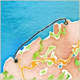
Aboard for this first passage: Tobi, and his longtime friends Bernhard and Martin. Departed Sant Carles Marina for Andratx, an overnight passage of roughly 1.7 days covering 120 nautical miles at 3.0 knots average. Wind 3–19 kn from the ENE, gusting to 25 kn. It backed from S to E. Seas up to 1.8m. Current up to 0.5 kn setting SW. This was the season’s first passage after an extensive refit break in the boatyard at Sant Carles Marina: a solar arch with 3×240 Wp of panels feeding the 48V main battery bank, finishing off the galley rebuild after going fully electric with an induction stovetop and a combined microwave/grill/oven, a full sandblast and recoat of the underwater hull (five coats of International Interprotect primer, three coats of Cruiser 250 antifouling), and a last-minute mast repair as the finishing touch. The passage itself brought considerably worse conditions than forecast (10 kn gusting to 15 kn and waves to 1m predicted, versus 20 kn gusting to 25 kn and waves to 2m actually experienced), including St. Elmo’s fire on the VHF antenna from late afternoon on (static buzzing on the radio, discharge even off the unplugged antenna cable), with a thunderstorm coming up on the port stern quarter four to five hours later, one that hadn’t been in the forecast at all, and two of the three aboard got seasick. Arrived in Andratx early in the morning and spent a day resting up.

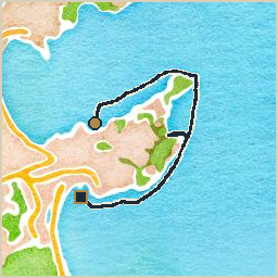
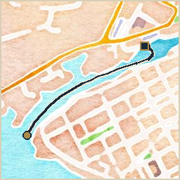
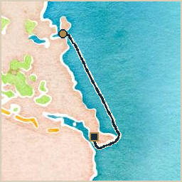
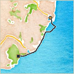
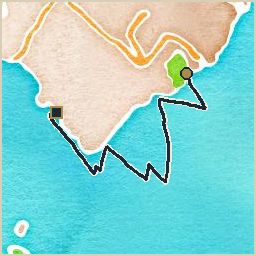
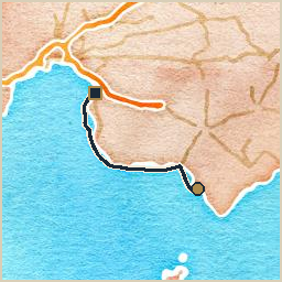
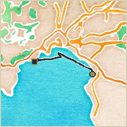
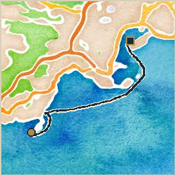
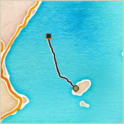
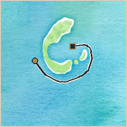
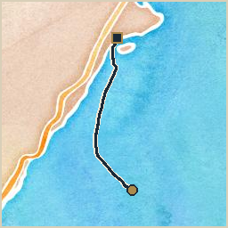
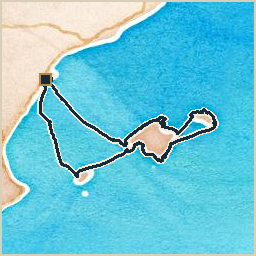
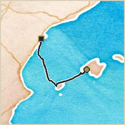
Watercolor-style map of the route from Sant Carles Marina to Andratx: a navy track line with a gold circle marking the start and a dark square marking the end

Tinarasia hauled out on stands in the boatyard, her hull sanded bare with fresh blue antifouling on the bottom, masts and rigging silhouetted against a dusky sky

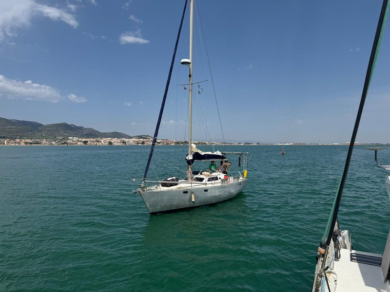
Tinarasia motoring away under bare poles across flat green-blue water, a low coastal town and hills in the background, seen from another boat

View across the anchorage at Port d'Andratx: a few sailboats at anchor, a small red lighthouse on the breakwater, and a hillside covered in white villas, with an inflatable dinghy beached in the foreground

on heavy weather, and being owed an apology

Forty hours out of Sant Carles Marina and already a thunderstorm, a building sea, and two thirds of the crew hanging over the leeward rail. Nobody asked my opinion on the forecast, which is typical, and nobody has thanked me for it since, which is not.

Wind and weather used to be mine to argue with. A Klabautermann who knew his trade could read a sky the way you lot read that glowing oracle box bolted at the chart table, and more than one ship in my long acquaintance owed her safe arrival to a knock on the hull an hour before the squall hit. Nobody knocked on anything this time. The forecast said ten knots and a meter of chop. What arrived was twenty, gusting worse, with St. Elmo’s fire crawling up the backstay like it owned the place. I take a certain professional satisfaction in that, if I’m honest. The sea does not read forecasts either.

Two of the three aboard learned some humility about it. The boat, to her credit, did not. She took the rough weather the way she takes everything these days: without complaint, without me, and without so much as a creak to let anyone know she’d noticed. An aluminum hull does not groan. I miss the groaning.

We are anchored off Andratx now, and there was a very large lunch, and I could have eaten my full share of it too, being quite capable of eating, drinking, and smoking my pipe same as any of you. Nobody sets a place for someone they cannot see, though, invisible being my usual state of affairs and not, whatever the crew seems to believe, a euphemism for absent. Fine. I’ll write about it instead.

andratx - port de sóller

Logbook

  • Departure: Andratx (39.5428, 2.3762), Saturday, April 25, 2026 at 08:45 UTC
  • Arrival: Port de Sóller (39.7933, 2.6913), Saturday, April 25, 2026 at 17:52 UTC
  • Duration: 9.1 h
  • Distance: 26.0 nm
  • Average speed: 2.9 kn
  • Hours & Distance under Motor: 6.1 h / 17.6 nm
  • Miles under Sail: 8.4 nm
  • Crew: Tobi, Bernhard, Martin

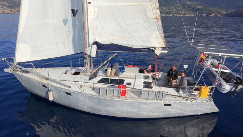
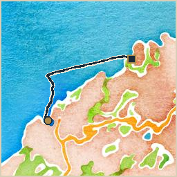
Andratx to Port de Sóller: a full day underway, 26 nautical miles at an average of 2.9 knots. Wind 3–8 kn from the NNW, gusting to 11 kn. Had to motor most of the way: the wind never really showed up. Got some very nice aerial shots of the boat with the DJI Neo drone along the way.

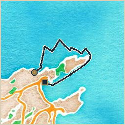
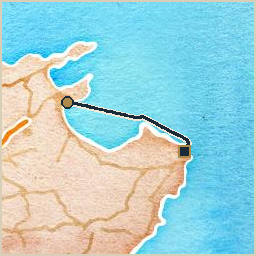
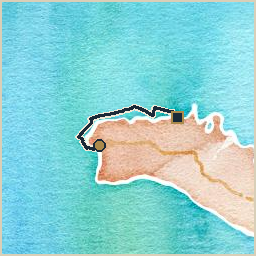
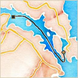
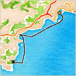
Watercolor-style map of the route from Andratx to Port de Sóller: a navy track line with a gold circle marking the start and a dark square marking the end

Aerial view of Tinarasia under sail, mainsail and headsail up, approaching a mountainous coastline under a partly cloudy sky

Aerial view looking down onto Tinarasia's deck under sail, showing three crew in the cockpit and the solar arch over the stern

port de sóller - cala tuent

Logbook

  • Departure: Port de Sóller (39.7954, 2.6900), Wednesday, April 29, 2026 at 12:17 UTC
  • Arrival: Cala Tuent (39.8420, 2.7734), Wednesday, April 29, 2026 at 14:41 UTC
  • Duration: 2.4 h
  • Distance: 6.3 nm
  • Average speed: 2.7 kn
  • Hours & Distance under Motor: 0.9 h / 2.4 nm
  • Miles under Sail: 3.9 nm
  • Crew: Tobi, Anna, Jo, Eli, Jofijaan

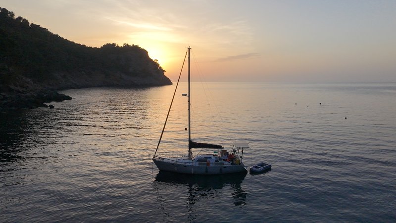
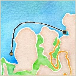
Port de Sóller to Cala Tuent: a short hop, 6 nautical miles at an average of 2.7 knots. Wind 6 kn from the ENE, gusting to 17 kn. While alongside in Port de Sóller, Bernhard headed home, Anna, Tobi’s partner and mother of Jo (3) and Eli (1), joined the boat with the kids, along with friend Jofijaan, and then Martin headed home too. Cala Tuent turned out to be a nice little cove with a beach and some hiking paths, somewhat spoiled by a huge tourist catamaran that kept ripping up the sea floor with its giant anchor every time it picked up passengers.

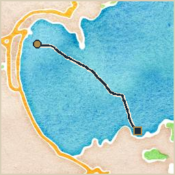
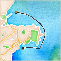
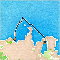
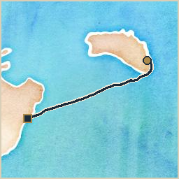
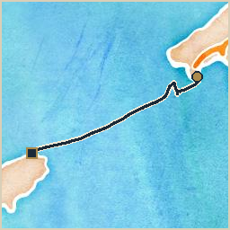
Watercolor-style map of the route from Port de Sóller to Cala Tuent: a navy track line with a gold circle marking the start and a dark square marking the end

A hanging BBQ grill off the stern rail, sausages and mushrooms cooking over the coals with smoke rising, a German flag flying above and a pine-covered cove with a pebble beach behind

Tinarasia at anchor in a calm cove at sunset, with a dinghy alongside and a headland silhouetted against the glowing sky

cala tuent - cala de sa calobra

Logbook

  • Departure: Cala Tuent (39.8444, 2.7724), Thursday, April 30, 2026 at 10:55 UTC
  • Arrival: Cala de Sa Calobra (39.8540, 2.8030), Thursday, April 30, 2026 at 11:44 UTC
  • Duration: 0.8 h
  • Distance: 2.1 nm
  • Average speed: 2.6 kn
  • Hours & Distance under Motor: 0.5 h / 1.2 nm
  • Miles under Sail: 0.9 nm
  • Crew: Tobi, Anna, Jo, Eli, Jofijaan

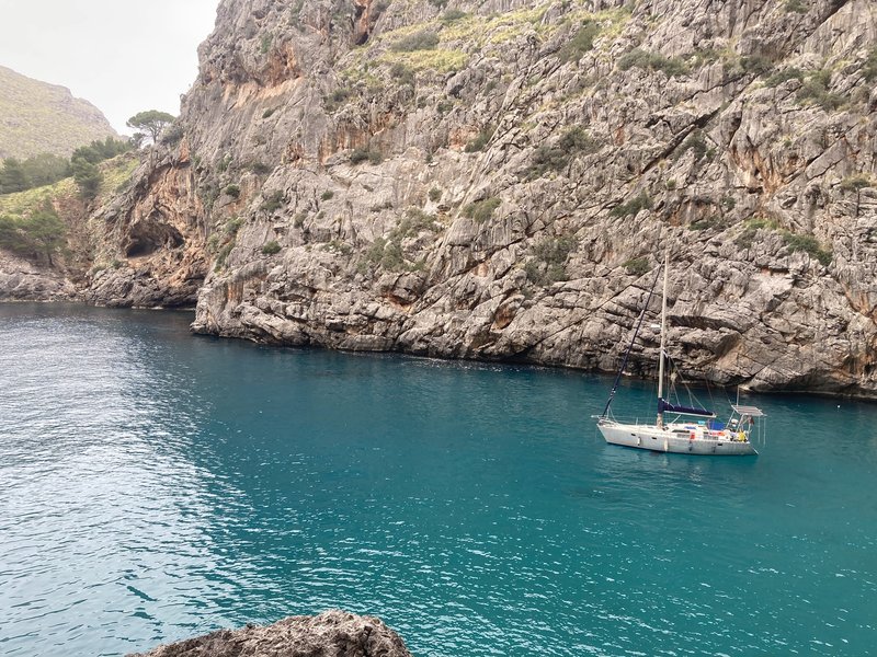
Cast off from Cala Tuent bound for Cala de Sa Calobra: a short hop, 2 nautical miles at an average of 2.6 knots. Wind 4 kn from the N, gusting to 13 kn. The beach here is narrow, no more than 40m or so, but behind it the Torrent de Pareis, a giant flood canyon, opens up to an absolutely breathtaking view. Anchored on a very gravelly bottom and nearly dragged overnight when the wind started funneling out of the torrent.

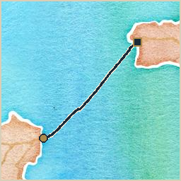
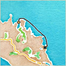
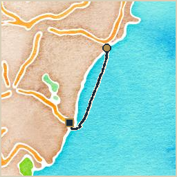
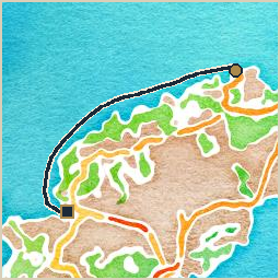
Watercolor-style map of the route from Cala Tuent to Cala de Sa Calobra: a navy track line with a gold circle marking the start and a dark square marking the end

Tinarasia at anchor in a narrow, steep-walled rocky cove with turquoise water

cala de sa calobra - port de sóller

Logbook

  • Departure: Cala de Sa Calobra (39.8558, 2.8020), Friday, May 1, 2026 at 08:57 UTC
  • Arrival: Port de Sóller (39.7921, 2.6923), Friday, May 1, 2026 at 11:15 UTC
  • Duration: 2.3 h
  • Distance: 7.8 nm
  • Average speed: 3.4 kn
  • Hours & Distance under Motor: 0.6 h / 0.9 nm
  • Miles under Sail: 7.0 nm
  • Crew: Tobi, Anna, Jo, Eli, Jofijaan

Underway from Cala de Sa Calobra toward Port de Sóller, a short hop: 8 nautical miles at an average of 3.4 knots. Wind 7–8 kn from the ENE, gusting to 24 kn. Seas up to 0.7m. Unfavorable weather ahead sent us back into Port de Sóller instead of continuing east. The kids loved the ice cream shops and the little train that runs from here up to the town of Sóller. Jofijaan left the boat here and flew home.

Watercolor-style map of the route from Cala de Sa Calobra to Port de Sóller: a navy track line with a gold circle marking the start and a dark square marking the end

on gravel, toddlers, and being outdone at my own job

Cala de Sa Calobra has a bottom made of loose gravel and a habit of funneling gusts straight down the gorge behind it at two in the morning, which is, incidentally, my shift. Warning a crew that their anchor is dragging is proper Klabautermann work. It is one of the oldest jobs in the trade, older than the pipe, nearly as old as the beard.

I did not get to do it. The boat’s glowing oracle box did it for me, chiming away belowdecks before I’d even finished climbing the chain to check. I am told this is called an anchor alarm. I am told it is very reliable. I would like it on the record that I was already awake.

The two smallest crew members, meanwhile, continue to outpace me on sheer capacity for mischief, which stings rather more than the alarm does. A proper ship’s spirit causes gentle chaos: a jammed halyard here, a misplaced marlinspike there, nothing a sailor can’t work around. A three-year-old and a one-year-old, once let loose on deck, achieve more disorder before breakfast than I have managed in several centuries of dedicated effort. I have taken notes.

We are back in Port de Sóller, so I had an ice cream. Pistachio, taken from an empty table while the crew were busy with the kids, and very good. I rode the little wooden train up to town afterward too, in the last carriage, with my boots up on the seat opposite the way you’re not supposed to, and nobody any the wiser. Being invisible is not the same as being absent, whatever the crew seems to think, and there is real pleasure in a good ride taken by someone nobody can see enjoying it.

The train stalled twice on the way, which will be my cousin’s doing. El Revisor runs with this line the way I run with Tinarasia, and he has never once let a locomotive through Sóller without stopping it somewhere scenic to remind the passengers who is actually in charge. Family is family. I didn’t say anything.

port de sóller - cala sant vicenç

Logbook

  • Departure: Port de Sóller (39.7961, 2.6887), Monday, May 4, 2026 at 07:20 UTC
  • Arrival: Cala Sant Vicenç (39.9237, 3.0593), Monday, May 4, 2026 at 15:44 UTC
  • Duration: 8.4 h
  • Distance: 20.8 nm
  • Average speed: 2.5 kn
  • Hours & Distance under Motor: 0.7 h / 2.0 nm
  • Miles under Sail: 18.8 nm
  • Crew: Tobi, Anna, Jo, Eli

Departed Port de Sóller for Cala Sant Vicenç, a full day underway covering 21 nautical miles at 2.5 knots average. Wind 1–6 kn from the SW, gusting to 23 kn. About 3 mm of rain fell along the way, with scattered lightning along the north coast. Jofijaan left the boat in Port de Sóller before this leg. Cala Sant Vicenç had a very nice, clean beach, though it was otherwise firmly on the tourist trail.

Watercolor-style map of the route from Port de Sóller to Cala Sant Vicenç: a navy track line with a gold circle marking the start and a dark square marking the end

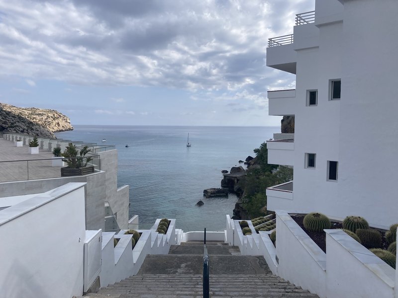
View down a white staircase past modern villas to a small rocky cove with a sailboat anchored offshore

cala sant vicenç - port de pollença

Logbook

  • Departure: Cala Sant Vicenç (39.9245, 3.0617), Wednesday, May 6, 2026 at 10:47 UTC
  • Arrival: Port de Pollença (39.9039, 3.0905), Wednesday, May 6, 2026 at 18:59 UTC
  • Duration: 8.2 h
  • Distance: 20.8 nm
  • Average speed: 2.5 kn
  • Hours & Distance under Motor: 2.6 h / 5.3 nm
  • Miles under Sail: 15.5 nm
  • Crew: Tobi, Anna, Jo, Eli

Left Cala Sant Vicenç and made for Port de Pollença, a full day underway covering 21 nautical miles at an average of 2.5 knots. Wind 3–7 kn from the ESE, gusting to 17 kn. It veered from NE to SSE. Motoring around Cap Formentor against wind and current, the autopilot pulled its own plug mid-turn, as it does now and then, earning it the nickname “Señor Seppuku” among the crew and a few minutes of hand-steering to finish the rounding. About 1 mm of rain fell along the way, with a few lightning strikes near the coast. Port de Pollença again, familiar territory after spending so much time there the year before. Met the crew of S/V Greta from Potsdam, another Trans-Ocean e.V. boat, and ran into Melusina One, with Vicky and Laurent aboard, the only Luxembourg-flagged boat we’ve ever encountered. A few beach breaks, one soggy dinghy ride back to the boat in pouring rain, and a great time overall.

Watercolor-style map of the route from Cala Sant Vicenç to Port de Pollença: a navy track line with a gold circle marking the start and a dark square marking the end

in which the tin helmsman resigns, briefly, mid-corner

We were rounding Cap Formentor under motor, wind and current both leaning hard against the whisper-screw, when the tin helmsman on the tiller decided it had had enough and pulled its own power plug loose. Not a fault, not a fuse, not so much as a warning chirp. It simply let go, in the middle of the turn, with the headland close aboard and the current doing its level best to put us somewhere we did not intend to go.

The crew has taken to calling it Señor Seppuku for this sort of thing, which I think is generous. In my day a helmsman who quit at the worst possible moment got a stern word and a watch below to think about it. This one got a nickname and, as far as I can tell, no consequences whatsoever. It will be back on duty by Tuesday, unrepentant.

I will admit, quietly, to a certain fellow feeling. There is something to be said for a piece of machinery that still knows how to make a dramatic exit. Everything else on this boat just hums along and does its job without complaint, which I have come to find almost insulting. At least the tin helmsman still has some theater in it.

Tobi took the tiller by hand for the rest of the rounding, which is, when you think about it, the only reason a Klabautermann’s job has existed on any ship since the first plank was laid: someone always has to take over when the mechanism gives up.

port de pollença - bonaire (mallorca)

Logbook

  • Departure: Port de Pollença (39.9012, 3.0885), Sunday, May 10, 2026 at 10:49 UTC
  • Arrival: Bonaire (Mallorca) (39.8676, 3.1386), Sunday, May 10, 2026 at 11:57 UTC
  • Duration: 1.1 h
  • Distance: 3.3 nm
  • Average speed: 2.9 kn
  • Hours & Distance under Motor: 0.5 h / 1.5 nm
  • Miles under Sail: 1.8 nm
  • Crew: Tobi, Anna, Jo, Eli

Left Port de Pollença and made for Bonaire (Mallorca), a short hop covering 3 nautical miles at an average of 2.9 knots. Wind 10 kn from the W, gusting to 24 kn. Seas up to 0.6m. A very speedy leg, sails set on a beam reach the whole way. Bonaire itself, on the other hand, may be the most boring place imaginable: we couldn’t even find a single open shop, so we left again.

Watercolor-style map of the route from Port de Pollença to Bonaire (Mallorca): a navy track line with a gold circle marking the start and a dark square marking the end

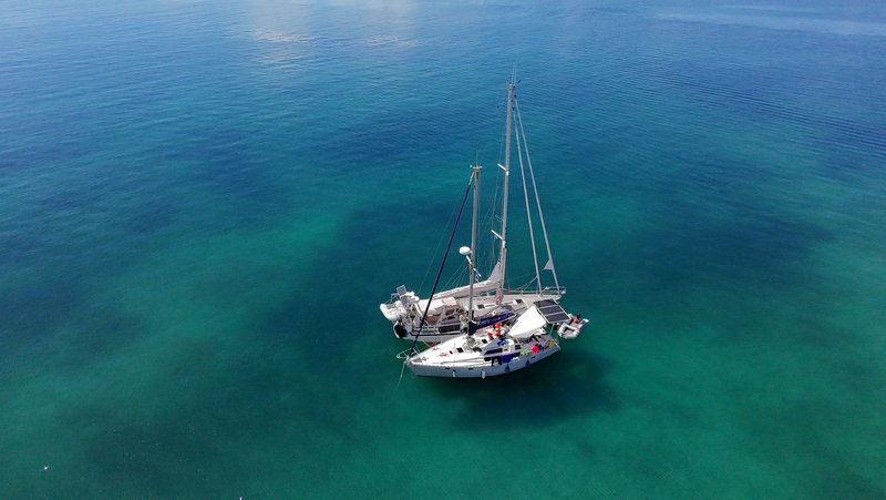
Aerial view of Tinarasia at anchor alone in clear turquoise water

Aerial view of Tinarasia rafted up alongside S/V Greta, with several crew sitting in the cockpits of both boats

bonaire (mallorca) - alcúdia

Logbook

  • Departure: Bonaire (Mallorca) (39.8692, 3.1416), Monday, May 11, 2026 at 10:34 UTC
  • Arrival: Alcúdia (39.8337, 3.1329), Monday, May 11, 2026 at 16:49 UTC
  • Duration: 6.3 h
  • Distance: 11.1 nm
  • Average speed: 1.8 kn
  • Hours & Distance under Motor: 3.6 h / 2.4 nm
  • Miles under Sail: 8.6 nm
  • Crew: Tobi, Anna, Jo, Eli

Underway from Bonaire (Mallorca) toward Alcúdia, a modest half-day’s sail: 11 nautical miles at an average of 1.8 knots. Wind 1–2 kn from the NNE, gusting to 10 kn. It backed from NW to SSE. Along the way, a break at a long pebbly beach with goats climbing through the rocks and bushes, and Tobi and Jo took the dinghy to explore some of the nearby caves. Anchored in the bay of Alcúdia and had some very nice beach days, met Frank on the 65ft catamaran Franke, and when the freshwater supplies started running low, filled up from his watermaker with a garden hose while tied up alongside.

Watercolor-style map of the route from Bonaire (Mallorca) to Alcúdia: a navy track line with a gold circle marking the start and a dark square marking the end

alcúdia - cala moltó

Logbook

  • Departure: Alcúdia (39.8314, 3.1341), Friday, May 15, 2026 at 10:17 UTC
  • Arrival: Cala Moltó (39.7282, 3.4558), Friday, May 15, 2026 at 15:11 UTC
  • Duration: 4.9 h
  • Distance: 18.6 nm
  • Average speed: 3.8 kn
  • Hours & Distance under Motor: 0.4 h / 1.7 nm
  • Miles under Sail: 16.8 nm
  • Crew: Tobi, Anna, Jo, Eli

Left Alcúdia and made for Cala Moltó, a modest half-day’s sail covering 19 nautical miles at an average of 3.8 knots. Wind 8–14 kn from the WNW, gusting to 31 kn. Seas up to 0.8m. The swell in the anchorage was horrible: even with a stern anchor down to keep the bow pointed into the waves, it was a rollercoaster ride all night.

Watercolor-style map of the route from Alcúdia to Cala Moltó: a navy track line with a gold circle marking the start and a dark square marking the end

cala moltó - cala ratjada

Logbook

  • Departure: Cala Moltó (39.7280, 3.4592), Friday, May 15, 2026 at 19:11 UTC
  • Arrival: Cala Ratjada (39.7081, 3.4640), Friday, May 15, 2026 at 19:54 UTC
  • Duration: 0.7 h
  • Distance: 2.4 nm
  • Average speed: 3.4 kn
  • Hours & Distance under Motor: 0.5 h / 1.4 nm
  • Miles under Sail: 1.0 nm
  • Crew: Tobi, Anna, Jo, Eli

Weighed anchor at Cala Moltó, bound for Cala Ratjada: a short hop covering 2 nautical miles at an average of 3.4 knots. Wind 5 kn from the NNE, gusting to 14 kn. Seas up to 0.5m. Got out of Cala Moltó just in time to run into a nasty squall barreling in from the northeast, and had to motor into Cala Ratjada at full throttle, thoroughly drenched. Tied up next to the gas station for the night before moving into a proper transit berth the next morning.

Watercolor-style map of the route from Cala Moltó to Cala Ratjada: a navy track line with a gold circle marking the start and a dark square marking the end

cala ratjada - cala degollador

Logbook

  • Departure: Cala Ratjada (39.7082, 3.4667), Sunday, May 17, 2026 at 11:19 UTC
  • Arrival: Cala Degollador (39.9940, 3.8294), Sunday, May 17, 2026 at 19:12 UTC
  • Duration: 7.9 h
  • Distance: 24.7 nm
  • Average speed: 3.1 kn
  • Hours & Distance under Motor: 0.4 h / 0.7 nm
  • Miles under Sail: 24.1 nm
  • Crew: Tobi, Anna, Jo, Eli, Björn

Underway from Cala Ratjada toward Cala Degollador, a modest half-day’s sail: 25 nautical miles at an average of 3.1 knots. Wind 9–12 kn from the S, gusting to 15 kn. Seas up to 0.7m. Björn, a friend of Anna’s from university, joined the crew in Cala Ratjada before this leg. A pleasant crossing to Menorca, ending with anchor down for the night in Cala Degollador.

Watercolor-style map of the route from Cala Ratjada to Cala Degollador: a navy track line with a gold circle marking the start and a dark square marking the end

a squall, a stranger, and a night at the fuel dock

We limped into Cala Ratjada two days ago with a squall barreling down out of the northeast, thick with lightning, and a full throttle dash into harbor with everyone soaked through before the lines were even out. No berth was waiting, so we spent that first night rafted at the fuel dock, which I am reliably informed is not glamorous, though I would point out that in several centuries of ship’s business I have slept in worse places than a pontoon that smells faintly of diesel nobody aboard this boat even burns anymore. By the next morning a proper berth had opened up and Cala Ratjada looked considerably friendlier in daylight, as harbors generally do.

Today Björn came aboard with a duffel bag and, as far as I can tell, no particular idea what he’d signed up for, having missed the squall entirely and arrived to find us already settled and smug about it. We cast off for Menorca this afternoon in the gentlest conditions the whole crossing has offered so far, which feels like a small injustice after what the boat put up with two nights ago.

I like a new face brought aboard on short notice regardless of the weather that greets him. It is the oldest kind of crewing there is: a stranger, a boat, and whatever the sea happens to be doing that particular week. Björn passed the test, for what my opinion is worth, which around here is not much, but I am on record as saying so.

cala degollador - ciutadella

Logbook

  • Departure: Cala Degollador (39.9965, 3.8250), Monday, May 18, 2026 at 08:01 UTC
  • Arrival: Ciutadella (40.0007, 3.8322), Monday, May 18, 2026 at 08:18 UTC
  • Duration: 0.3 h
  • Distance: 0.5 nm
  • Average speed: 1.9 kn
  • Hours & Distance under Motor: 0.2 h / 0.5 nm
  • Miles under Sail: 0.0 nm
  • Crew: Tobi, Anna, Jo, Eli, Björn

Cala Degollador to Ciutadella: a short hop, 1 nautical miles at an average of 1.9 knots. Wind 4 kn from the SW, gusting to 11 kn. Logbook only, for now: the real story of the passage itself is still waiting to be filled in.

Watercolor-style map of the route from Cala Degollador to Ciutadella: a navy track line with a gold circle marking the start and a dark square marking the end

ciutadella - cala pregonda

Logbook

  • Departure: Ciutadella (40.0001, 3.8324), Tuesday, May 19, 2026 at 07:51 UTC
  • Arrival: Cala Pregonda (40.0583, 4.0445), Tuesday, May 19, 2026 at 14:45 UTC
  • Duration: 6.9 h
  • Distance: 19.8 nm
  • Average speed: 2.9 kn
  • Hours & Distance under Motor: 3.7 h / 10.7 nm
  • Miles under Sail: 9.0 nm
  • Crew: Tobi, Anna, Jo, Eli, Björn

Slipped the lines at Ciutadella and pointed the bow toward Cala Pregonda, a modest half-day’s sail covering 20 nautical miles at an average of 2.9 knots. Wind 6–8 kn from the SSW, gusting to 19 kn. Cala Pregonda turned out to be an absolutely stunning anchorage: beautiful beaches, turquoise water, and a handful of tiny islands with spectacular geology and natural salines that made the place look a bit like the moon.

Watercolor-style map of the route from Ciutadella to Cala Pregonda: a navy track line with a gold circle marking the start and a dark square marking the end

A jagged reddish-orange rock formation rising from turquoise water, with green hills and a white house in the background at low sun

cala pregonda - port de fornells

Logbook

  • Departure: Cala Pregonda (40.0605, 4.0459), Wednesday, May 20, 2026 at 12:03 UTC
  • Arrival: Port de Fornells (40.0537, 4.1341), Wednesday, May 20, 2026 at 15:12 UTC
  • Duration: 3.1 h
  • Distance: 8.3 nm
  • Average speed: 2.6 kn
  • Hours & Distance under Motor: 0.4 h / 1.0 nm
  • Miles under Sail: 7.3 nm
  • Crew: Tobi, Anna, Jo, Eli, Björn

Cast off from Cala Pregonda bound for Port de Fornells: a short hop, 8 nautical miles at an average of 2.6 knots. Wind 3–5 kn from the ESE, gusting to 14 kn. The communal harbor in Fornells was very clean, but the whole town gave off the impression of having been built solely for tourism.

Watercolor-style map of the route from Cala Pregonda to Port de Fornells: a navy track line with a gold circle marking the start and a dark square marking the end

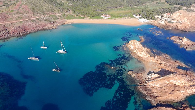
Aerial view of four sailboats anchored in a turquoise bay with a sandy beach, backed by rocky reddish cliffs and green hills

port de fornells - cala grao

Logbook

  • Departure: Port de Fornells (40.0563, 4.1340), Thursday, May 21, 2026 at 10:39 UTC
  • Arrival: Cala Grao (39.9531, 4.2736), Thursday, May 21, 2026 at 14:31 UTC
  • Duration: 3.9 h
  • Distance: 12.0 nm
  • Average speed: 3.1 kn
  • Hours & Distance under Motor: 1.0 h / 2.8 nm
  • Miles under Sail: 9.2 nm
  • Crew: Tobi, Anna, Jo, Eli, Björn

Set a course from Port de Fornells to Cala Grao: a short hop, 12 nautical miles at an average of 3.1 knots. Wind 5–6 kn from the NNE, gusting to 15 kn. Current up to 0.5 kn setting ESE. Behind the anchorage, towards the main beach, there’s a very large flat area that’s only ankle- to knee-deep. Tobi and Jo went exploring the beach on one of the bigger islands in the area.

Watercolor-style map of the route from Port de Fornells to Cala Grao: a navy track line with a gold circle marking the start and a dark square marking the end

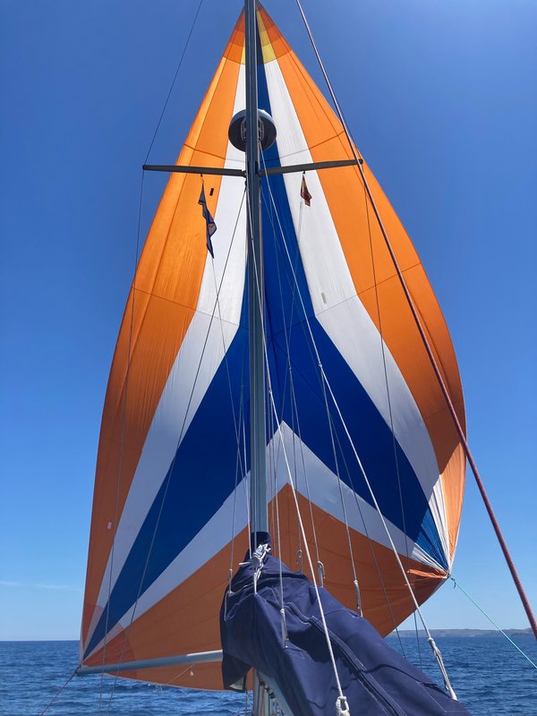
Looking up the mast at a full, colorful asymmetric spinnaker in orange, white, and blue, set against a clear blue sky

cala grao - cala teulera

Logbook

  • Departure: Cala Grao (39.9532, 4.2768), Friday, May 22, 2026 at 11:13 UTC
  • Arrival: Cala Teulera (39.8766, 4.3066), Friday, May 22, 2026 at 13:42 UTC
  • Duration: 2.5 h
  • Distance: 7.1 nm
  • Average speed: 2.9 kn
  • Hours & Distance under Motor: 0.6 h / 2.0 nm
  • Miles under Sail: 5.2 nm
  • Crew: Tobi, Anna, Jo, Eli, Björn

Underway from Cala Grao toward Cala Teulera, a short hop: 7 nautical miles at an average of 2.9 knots. Wind 5 kn from the ESE, gusting to 14 kn. Anchored in Cala Teulera, which was pretty packed with boats, being the only “free” anchorage in the impressive natural harbor of Mahón.

Watercolor-style map of the route from Cala Grao to Cala Teulera: a navy track line with a gold circle marking the start and a dark square marking the end

cala teulera - club marítimo de mahón

Logbook

  • Departure: Cala Teulera (39.8742, 4.3071), Saturday, May 23, 2026 at 07:13 UTC
  • Arrival: Club Marítimo de Mahón (39.8895, 4.2788), Saturday, May 23, 2026 at 08:05 UTC
  • Duration: 0.9 h
  • Distance: 2.3 nm
  • Average speed: 2.7 kn
  • Hours & Distance under Motor: 0.5 h / 1.3 nm
  • Miles under Sail: 1.0 nm
  • Crew: Tobi, Anna, Jo, Eli, Björn

Weighed anchor at Cala Teulera, bound for Club Marítimo de Mahón: a short hop covering 2 nautical miles at an average of 2.7 knots. Wind 2 kn from the NE, gusting to 9 kn. This was really just the move from the anchorage into the harbor proper, where we tied up in a guest berth at the club.

Watercolor-style map of the route from Cala Teulera to Club Marítimo de Mahón: a navy track line with a gold circle marking the start and a dark square marking the end

View from the boat's stern rail across the water to a round stone watchtower on a green, rocky headland, with a German flag flying in the foreground

club marítimo de mahón - porto cristo

Logbook

  • Departure: Club Marítimo de Mahón (39.8873, 4.2790), Sunday, May 24, 2026 at 09:21 UTC
  • Arrival: Porto Cristo (39.5387, 3.3377), Monday, May 25, 2026 at 05:16 UTC
  • Duration: 19.9 h
  • Distance: 53.9 nm
  • Average speed: 2.7 kn
  • Hours & Distance under Motor: 2.1 h / 5.3 nm
  • Miles under Sail: 48.7 nm
  • Crew: Tobi, Anna, Jo, Eli, Björn
  • Time/distance more than 12 nm offshore: 3.4 h / 8.2 nm

Underway from Club Marítimo de Mahón toward Porto Cristo, a long day that ran past sunset: 54 nautical miles at an average of 2.7 knots. Wind 3–8 kn from the ENE, gusting to 10 kn. It veered from N to ESE. We knew going in this would be a very slow passage, with barely any wind in the forecast for most of it. Decided against aiming for Cala Ratjada and went straight for Porto Cristo instead.

Watercolor-style map of the route from Club Marítimo de Mahón to Porto Cristo: a navy track line with a gold circle marking the start and a dark square marking the end

on very slow days, and the tyranny of no wind at all

Twenty hours from Mahón to Porto Cristo, and for most of it there was nothing to do. Nothing for the crew, who mostly slept in shifts. Nothing for the whisper-screw, which barely turned over. Nothing, worst of all, for me. A proper gale gives a Klabautermann plenty to occupy himself with: lines to worry over, a hull to listen to, a crew to keep half an eye on in case anyone does something regrettable. Dead calm gives a spirit nothing but time.

The forecast had promised barely any wind for most of the route, and the forecast, for once, was entirely correct, which I found almost more irritating than if it had been wrong. There is no drama in being right about nothing happening. The crew skipped a planned stop in Cala Ratjada altogether rather than break up the tedium, on the sound theory that one very long boring day beats two shorter boring days with a middle stop that changes nothing.

I spent a good part of the crossing considering retirement. Not seriously, you understand. But a spirit who mends what needs mending starts to feel surplus to requirements on a boat that so rarely needs mending, and a whole day of flat water and a self-sufficient tin helmsman does invite the thought. I am told there are caves worth a look here in Porto Cristo. Unlike me, at least a cave has something to show for standing still for several thousand years.

porto cristo - portocolom

Logbook

  • Departure: Porto Cristo (39.5367, 3.3390), Tuesday, May 26, 2026 at 12:05 UTC
  • Arrival: Portocolom (39.4217, 3.2643), Tuesday, May 26, 2026 at 15:32 UTC
  • Duration: 3.4 h
  • Distance: 9.4 nm
  • Average speed: 2.7 kn
  • Hours & Distance under Motor: 1.0 h / 2.4 nm
  • Miles under Sail: 7.0 nm
  • Crew: Tobi, Anna, Jo, Eli, Björn

Left Porto Cristo and made for Portocolom, a short hop covering 9 nautical miles at an average of 2.7 knots. Wind 9–10 kn from the E, gusting to 21 kn. While in Porto Cristo we went to see the Cuevas dels Hams (fish hook caves), which were a bit disappointing: the whole family liked the Cuevas del Drach (dragon caves), visited last year, better.

Watercolor-style map of the route from Porto Cristo to Portocolom: a navy track line with a gold circle marking the start and a dark square marking the end

A black-and-white striped lighthouse atop a rocky headland, seen from the water under a clear blue sky

portocolom - cala mondragó

Logbook

  • Departure: Portocolom (39.4199, 3.2663), Thursday, May 28, 2026 at 10:07 UTC
  • Arrival: Cala Mondragó (39.3497, 3.1906), Thursday, May 28, 2026 at 14:07 UTC
  • Duration: 4.0 h
  • Distance: 7.0 nm
  • Average speed: 1.8 kn
  • Hours & Distance under Motor: 1.2 h / 2.2 nm
  • Miles under Sail: 4.8 nm
  • Crew: Tobi

Departed Portocolom for Cala Mondragó, a modest half-day’s sail covering 7 nautical miles at 1.8 knots average. Wind 6–9 kn from the SSW, gusting to 20 kn. Anna, Jo, Eli, and Björn left for the airport that morning while the boat was still in Portocolom, so this was Tobi’s first solo leg of the season. Originally wanted to go to Portopetro, but it didn’t look very inviting, so continued on to Cala Mondragó instead.

Watercolor-style map of the route from Portocolom to Cala Mondragó: a navy track line with a gold circle marking the start and a dark square marking the end

View out through the mouth of a dark sea cave toward a sailboat anchored in a sunlit bay lined with pine trees

cala mondragó - platja des carbó

Logbook

  • Departure: Cala Mondragó (39.3476, 3.1925), Friday, May 29, 2026 at 08:38 UTC
  • Arrival: Platja des Carbó (39.3062, 3.0131), Friday, May 29, 2026 at 18:22 UTC
  • Duration: 9.7 h
  • Distance: 25.0 nm
  • Average speed: 2.6 kn
  • Hours & Distance under Motor: 2.2 h / 5.0 nm
  • Miles under Sail: 20.0 nm
  • Crew: Tobi

Departed Cala Mondragó for Platja des Carbó, a full day underway covering 25 nautical miles at 2.6 knots average. Wind 6–11 kn from the WSW, gusting to 22 kn. Platja des Carbó turned out to be a nice shallow anchorage south of Colonia de Sant Jordi.

Watercolor-style map of the route from Cala Mondragó to Platja des Carbó: a navy track line with a gold circle marking the start and a dark square marking the end

platja des carbó - s'arenal

Logbook

  • Departure: Platja des Carbó (39.3153, 3.0010), Saturday, May 30, 2026 at 09:45 UTC
  • Arrival: S’Arenal (39.5011, 2.7452), Saturday, May 30, 2026 at 18:58 UTC
  • Duration: 9.2 h
  • Distance: 23.1 nm
  • Average speed: 2.5 kn
  • Hours & Distance under Motor: 3.0 h / 4.0 nm
  • Miles under Sail: 19.1 nm
  • Crew: Tobi

Left Platja des Carbó and made for S’Arenal, a full day underway covering 23 nautical miles at an average of 2.5 knots. Wind 3–7 kn from the SSW, gusting to 17 kn. Club Nàutic de S’Arenal was way overpriced, so stayed in the anchorage south of the marina instead, and went ashore with the dinghy to check out Balneario 6 and the crazy German party scene there.

Watercolor-style map of the route from Platja des Carbó to S'Arenal: a navy track line with a gold circle marking the start and a dark square marking the end

s'arenal - ses illetes

Logbook

  • Departure: S’Arenal (39.5035, 2.7453), Sunday, May 31, 2026 at 08:18 UTC
  • Arrival: Ses Illetes (39.5299, 2.5850), Sunday, May 31, 2026 at 13:25 UTC
  • Duration: 5.1 h
  • Distance: 10.5 nm
  • Average speed: 2.1 kn
  • Hours & Distance under Motor: 2.9 h / 3.4 nm
  • Miles under Sail: 7.1 nm
  • Crew: Tobi

Departed S’Arenal for Ses Illetes, a modest half-day’s sail covering 10 nautical miles at 2.1 knots average. Wind 3–8 kn from the SSW, gusting to 11 kn. With a short stopover at the breakwater of Sa Ràpita to meet up with Anja and Denny (met earlier in the “other” La Ràpita, on the mainland), headed for an anchorage west of Palma to spend the night, planning to head into the Real Club Náutico de Palma marina the next day.

Watercolor-style map of the route from S'Arenal to Ses Illetes: a navy track line with a gold circle marking the start and a dark square marking the end

ses illetes - palma de mallorca

Logbook

  • Departure: Ses Illetes (39.5277, 2.5847), Monday, June 1, 2026 at 07:48 UTC
  • Arrival: Palma de Mallorca (39.5630, 2.6340), Monday, June 1, 2026 at 10:37 UTC
  • Duration: 2.8 h
  • Distance: 4.4 nm
  • Average speed: 1.6 kn
  • Hours & Distance under Motor: 1.4 h / 3.7 nm
  • Miles under Sail: 0.7 nm
  • Crew: Tobi, Anatol

Slipped the lines at Ses Illetes and pointed the bow toward Palma de Mallorca, a short hop covering 4 nautical miles at an average of 1.6 knots. Wind 3 kn from the SSE, gusting to 12 kn. It veered from ESE to S. Motoring into the huge harbor at Palma is always a bit exciting. The reception at RCNP (Real Club Náutico de Palma) was great as always, and Anatol, a friend of Tobi and Anna’s, came aboard here as welcome reinforcement.

Watercolor-style map of the route from Ses Illetes to Palma de Mallorca: a navy track line with a gold circle marking the start and a dark square marking the end

palma de mallorca - portals vells

Logbook

  • Departure: Palma de Mallorca (39.5609, 2.6327), Tuesday, June 2, 2026 at 09:46 UTC
  • Arrival: Portals Vells (39.4735, 2.5256), Tuesday, June 2, 2026 at 16:16 UTC
  • Duration: 6.5 h
  • Distance: 10.5 nm
  • Average speed: 1.6 kn
  • Hours & Distance under Motor: 5.2 h / 6.5 nm
  • Miles under Sail: 4.0 nm
  • Crew: Tobi, Anatol

Palma de Mallorca to Portals Vells: a modest half-day’s sail, 10 nautical miles at an average of 1.6 knots. Wind 5–6 kn from the SW, gusting to 16 kn. It veered from SSE to WNW. Current up to 0.7 kn setting ESE. On the way back toward the mainland, decided not to make the hop to Ibiza in nasty weather, and instead waited it out in this forked bay with little caves in the cliffs.

Watercolor-style map of the route from Palma de Mallorca to Portals Vells: a navy track line with a gold circle marking the start and a dark square marking the end

Several boats anchored in a small bay backed by sandy cliffs and white villas among pine trees

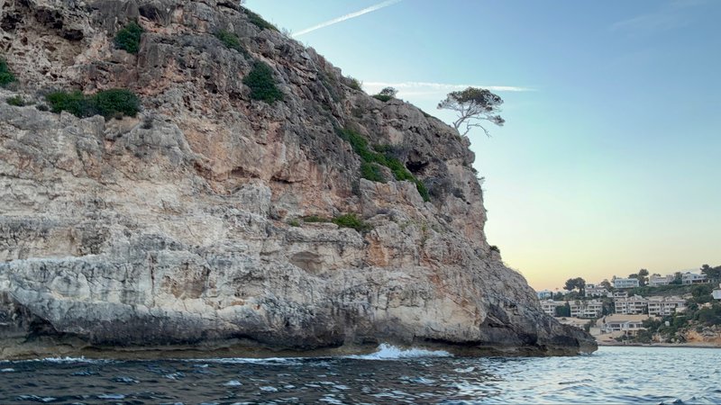
A tall sandy-colored cliff with a lone pine tree at its edge, waves breaking at its base, with a village visible in the distance at dusk

portals vells - cala portinatx

Logbook

  • Departure: Portals Vells (39.4727, 2.5244), Wednesday, June 3, 2026 at 08:33 UTC
  • Arrival: Cala Portinatx (39.1125, 1.5139), Thursday, June 4, 2026 at 02:38 UTC
  • Duration: 18.1 h
  • Distance: 60.2 nm
  • Average speed: 3.3 kn
  • Hours & Distance under Motor: 7.8 h / 19.5 nm
  • Miles under Sail: 40.7 nm
  • Crew: Tobi, Anatol

Slipped the lines at Portals Vells and pointed the bow toward Cala Portinatx, a long day that ran past sunset covering 60 nautical miles at an average of 3.3 knots. Wind 0–13 kn from the SSE, gusting to 16 kn. It veered from NE to S. Seas up to 1.4m. Current up to 0.5 kn setting NNE. Partway across, briefly considered turning back for Port d’Andratx to wait out weakening wind, but talked ourselves out of it and held course for Ibiza. Long overnight passage: arrived in the dark and had to dodge mooring balls to get to an anchoring spot near the beach.

Watercolor-style map of the route from Portals Vells to Cala Portinatx: a navy track line with a gold circle marking the start and a dark square marking the end

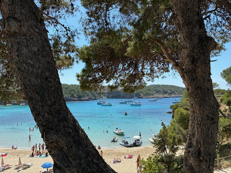
View between two pine trees down to a turquoise bay with anchored boats and a sandy beach crowded with sunbathers

cala portinatx - sant antoni de portmany

Logbook

  • Departure: Cala Portinatx (39.1140, 1.5125), Friday, June 5, 2026 at 13:49 UTC
  • Arrival: Sant Antoni de Portmany (38.9761, 1.3009), Friday, June 5, 2026 at 19:07 UTC
  • Duration: 5.3 h
  • Distance: 17.3 nm
  • Average speed: 3.3 kn
  • Hours & Distance under Motor: 0.7 h / 1.6 nm
  • Miles under Sail: 15.8 nm
  • Crew: Tobi, Anatol

Left Cala Portinatx and made for Sant Antoni de Portmany, a modest half-day’s sail covering 17 nautical miles at an average of 3.3 knots. Wind 6–9 kn from the ESE, gusting to 22 kn. Seas up to 1.0m. The reception at Marina Es Nàutic in Sant Antoni was great, a marinero named Leo helped us a lot. Shortly after we tied up, Melusina One surprised us by pulling into a berth on the same pontoon. The town itself was a bit bizarre and very party-oriented.

Watercolor-style map of the route from Cala Portinatx to Sant Antoni de Portmany: a navy track line with a gold circle marking the start and a dark square marking the end

A harbor breakwater with a pile of rocks in the foreground and a dense skyline of white apartment buildings behind, under a pastel evening sky

an old acquaintance, and a pontoon too small for coincidence

A calm, unremarkable afternoon hop brought us into Sant Antoni in broad daylight, a welcome change after the long, dark, weakening-wind crossing to Cala Portinatx the night before. We were barely made fast to the pontoon before Melusina One pulled in behind us and rafted up practically on top of our own stern cleat. The only Luxembourg-flagged boat this crew has ever met, twice now, the second time by nothing but sheer bad odds.

I do not believe in coincidence, professionally speaking. A spirit who has spent centuries reading currents and crossings learns that the sea is smaller than it looks and considerably more repetitive than sailors like to admit. Boats on similar routes, at similar speeds, chasing similar weather windows, tend to keep bumping into one another whether either crew intends it or not. That is not fate. That is just how currents and calendars work.

Still, I will allow that it was a pleasant surprise, and that Vicky and Laurent are good company for a crew that has been mostly talking to itself and one moody helmsman for the past several days. The marinero here, a fellow named Leo, deserves a mention too, for getting everyone sorted without incident, though this time in broad daylight rather than by torchlight. Sant Antoni itself I will reserve judgment on. A town built entirely around the young and the loud is not my usual haunt, but then again, neither was any port until someone built one there.

sant antoni de portmany - illa grossa

Logbook

  • Departure: Sant Antoni de Portmany (38.9748, 1.2981), Saturday, June 6, 2026 at 11:36 UTC
  • Arrival: Illa Grossa (39.8976, 0.6811), Sunday, June 7, 2026 at 13:21 UTC
  • Duration: 25.7 h
  • Distance: 69.8 nm
  • Average speed: 2.7 kn
  • Hours & Distance under Motor: 1.5 h / 2.7 nm
  • Miles under Sail: 67.1 nm
  • Crew: Tobi, Anatol
  • Time/distance more than 12 nm offshore: 13.2 h / 36.1 nm

Departed Sant Antoni de Portmany for Illa Grossa, an overnight passage of roughly 1.1 days covering 70 nautical miles at 2.7 knots average. Wind 2–14 kn from the E, gusting to 18 kn. It backed from SE to ENE. Current up to 1.1 kn setting W. Quiet crossing, took shifts sleeping; the one exception was a pod of about 20 dolphins that showed up at dawn and kept us company for a good 20 minutes. Arrival was a bit scary: the bay was like a witches’ cauldron, with strong gusts blowing directly into the crater bay and no safe way to get inside, so we decided to pick up a mooring outside the rim instead of anchoring inside.

Watercolor-style map of the route from Sant Antoni de Portmany to Illa Grossa: a navy track line with a gold circle marking the start and a dark square marking the end

A rocky island with a lighthouse, seen across open water past the boat's bow rail and rigging

illa grossa - illa grossa

Logbook

  • Departure: Illa Grossa (39.8951, 0.6815), Monday, June 8, 2026 at 07:13 UTC
  • Arrival: Illa Grossa (39.8970, 0.6880), Monday, June 8, 2026 at 07:36 UTC
  • Duration: 0.4 h
  • Distance: 0.9 nm
  • Average speed: 2.2 kn
  • Hours & Distance under Motor: 0.3 h / 0.5 nm
  • Miles under Sail: 0.4 nm
  • Crew: Tobi, Anatol

Departed Illa Grossa for Illa Grossa, a short hop covering 1 nautical miles at 2.2 knots average. Wind 3 kn from the E, gusting to 5 kn. Seas up to 0.5m. Current up to 0.9 kn setting WSW. There was a thunderstorm over the mainland that day, well out of reach of the anchorage. The weather had calmed down a lot, so we moved into the crater bay itself and called the park rangers on VHF to ask for a guided tour: fascinating stories about the history, geography, and biology of the islands. The crater turned out to be inhabited after all: two or three rangers and biologists live there, doubling as the local tour guides.

Watercolor-style map of the route from Illa Grossa to Illa Grossa: a navy track line with a gold circle marking the start and a dark square marking the end

Two people walking along a paved path through scrubby vegetation toward the sea, with small rocky islets visible offshore

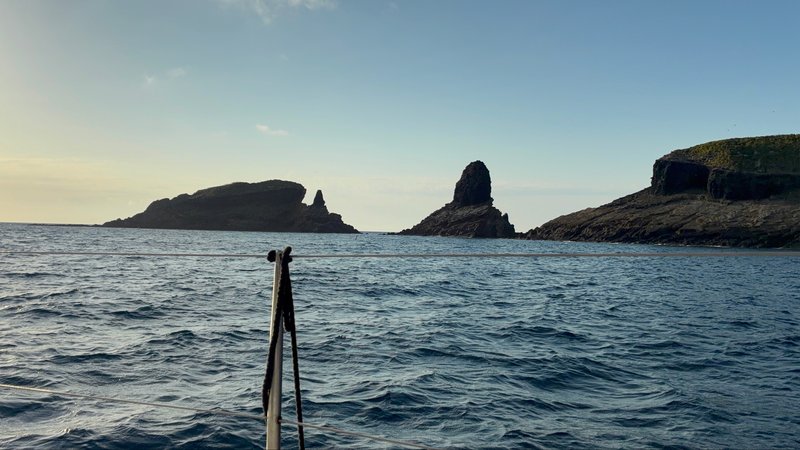
Jagged volcanic rock islets rising from the sea at dawn, seen past the boat's bow pulpit

illa grossa - sant carles de la ràpita

Logbook

  • Departure: Illa Grossa (39.8992, 0.6899), Tuesday, June 9, 2026 at 06:45 UTC
  • Arrival: Sant Carles de la Ràpita (40.6159, 0.5970), Tuesday, June 9, 2026 at 21:41 UTC
  • Duration: 14.9 h
  • Distance: 49.7 nm
  • Average speed: 3.3 kn
  • Hours & Distance under Motor: 4.0 h / 10.3 nm
  • Miles under Sail: 39.4 nm
  • Crew: Tobi, Anatol

Illa Grossa to Sant Carles de la Ràpita: a long day that ran past sunset, 50 nautical miles at an average of 3.3 knots. Wind 7–14 kn from the ENE, gusting to 18 kn. It veered from NNE to E. Seas up to 0.9m. A thunderstorm cell sat inland that day, off to the side of the route. This leg had it all: long waves, short waves, lots of wind, almost no wind. Towards the end we motored for quite a few hours. The destination was the Club Nàutic de la Ràpita, where the boat has a year-round berth for now while waiting on the next round of refit work.

Watercolor-style map of the route from Illa Grossa to Sant Carles de la Ràpita: a navy track line with a gold circle marking the start and a dark square marking the end

A glowing orange sunset over a mountainous coastline, seen from the boat's cockpit with instruments and railing in the foreground

Tinarasia moored stern-to at a marina pontoon, with her name and homeport painted on the transom and other yachts in the background

home again, and a season's accounting

Seven weeks, and the last of it was the strangest stretch: a crater bay out at the Columbretes that turned into a proper witches’ cauldron on arrival, gusts pouring straight in with no safe way through, so we sat a night on a mooring outside the rim like sensible people before going in to meet the two or three park rangers who apparently live out there full time. I have met stranger crews. I have not met many stranger addresses.

Now we are back where we started, less than a mile from the yard that spent all winter turning this boat into something with considerably less use for me. A season’s accounting, then, since somebody ought to keep one. Six hundred and fifty-some miles. A storm nobody forecast. A tin helmsman who quit once, dramatically, mid-corner, and was reinstated without so much as an apology. Two small crew members who have both gotten noticeably taller since April, which I understand is normal for their kind and still finds me unprepared for it every single season.

I did not fix a single thing that actually needed fixing this year. The hull held. The rigging held. The whisper-screw and the weird black planks and the glowing oracle box all did exactly what they were built to do, without me, the entire way around. So I wrote about it instead, in the margins of this blogbook, which is apparently what a ship’s spirit does now in the golden age of nothing breaking. I am told there is a refit coming this winter. I live in hope.

spring 2026: a season in review

Watercolor-style map of the full spring 2026 route: a navy track line looping from the Spanish mainland out to Mallorca, around Menorca, down to Ibiza, and out to the Columbretes and back, with a gold circle marking the start and a dark square marking the end

S/V Tinarasia came out of the water at Sant Carles Marina last summer with a long refit list and went back in this spring a genuinely different boat. Seven weeks and 655.6 nautical miles later, she’s tied up at the Club Nàutic de la Ràpita, less than a mile from where the season began, having covered the Spanish mainland coast, most of Mallorca, all the way around Menorca, a slice of Ibiza, and a genuinely remote volcanic archipelago most sailors have never heard of. Along the way: a thunderstorm nobody forecast, two small kids growing visibly over the course of a season, a pod of twenty dolphins at dawn, and a first proper singlehanded passage for the skipper.

A winter well spent
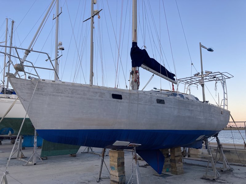
Tinarasia hauled out on stands in the boatyard, her hull sanded bare with fresh blue antifouling on the bottom, masts and rigging silhouetted against a dusky sky

The refit that kept Tinarasia ashore over the winter wasn’t cosmetic. A new solar arch went up at the stern, three panels of 240 watts each for 720 watts total, feeding a 48-volt house battery bank built to carry the boat’s growing electrical appetite. The galley finished its transition to fully electric: an induction cooktop and a combined microwave/grill/oven took over from what remained of the gas system. Underwater, the hull got a proper sandblast down to bare aluminum and a complete rebuild of the anti-corrosion and antifouling system: five coats of International Interprotect primer, three coats of Cruiser 250 antifouling on top. A mast repair came in right at the end, the last item ticked off before the yard season closed.

None of it was for show. Tinarasia’s propulsion is fully electric (a Motenergy ME-1115, rated at 10 kW, driving through a reduction gearbox, with no diesel anywhere on the boat), and it lives or dies on how well the solar and battery side of the equation is sorted. Getting that right over the winter is the reason this season could rack up 529.0 nautical miles under sail alone and still have the motor there, quietly, whenever conditions called for it: 126.6 nautical miles’ worth, between pure motoring and motor-assisted sailing, all of it drawn from sunlight rather than a fuel dock. When there’s plenty of sun and not much wind, that setup makes “solar sailing” possible: throttle the motor back until its draw matches whatever the panels are producing, and in calm conditions Tinarasia can hold a bit over 2 knots without pulling a single amp from the batteries.

The roughest weather of the season, on day one
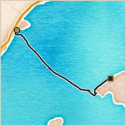
Watercolor-style map of the route from Sant Carles Marina to Port de Sóller: a navy track line with a gold circle marking the start and a dark square marking the end

The new season opened with its toughest test immediately. Departing Sant Carles Marina nonstop for Andratx (at 120 nautical miles and just under forty hours, the longest single leg of the whole trip), the forecast had promised 10 knots of wind, gusting to 15, with waves to a meter. What actually arrived was 20 knots gusting to 25, waves to two meters, and, completely unforecast, a thunderstorm. From late afternoon on, St. Elmo’s fire built on the VHF antenna (a static buzz on the radio, and small discharges visible even off the unplugged antenna cable) before the storm itself came up on the port stern quarter four or five hours later, an alarming but genuinely rare thing to witness from a small boat at sea. Two of the three aboard got seasick for their trouble. Andratx, reached in the small hours of the morning, earned its rest day at anchor and its unusually large lunch.
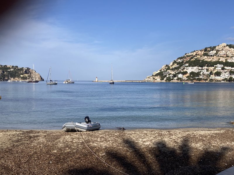
View across the anchorage at Port d'Andratx: a few sailboats at anchor, a small red lighthouse on the breakwater, and a hillside covered in white villas, with an inflatable dinghy beached in the foreground

Family life aboard, Mallorca and Menorca
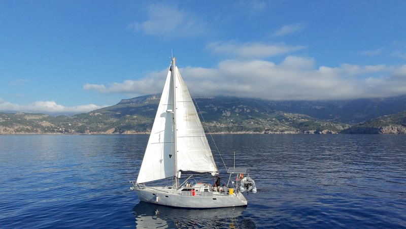
Aerial view of Tinarasia under sail, mainsail and headsail up, approaching a mountainous coastline under a partly cloudy sky

The weather calmed considerably after that, and the character of the season changed with it. Anna, Jo, and Eli came aboard in Port de Sóller, along with friend Jofijaan, and the boat settled into the kind of short, island-hopping rhythm that works for a crew with a three-year-old and a one-year-old: Cala Tuent’s pretty little bay, marred only by a day-tripper catamaran that ploughed up the seabed with an oversized anchor on every passenger change; Cala de Sa Calobra’s dramatic canyon walls and unsettling gravel holding ground, which cost the crew an anxious night wondering if the anchor would hold against gusts pouring down out of the gorge. Jofijaan left the boat again in Port de Sóller a week later, flying home after a short stint aboard.
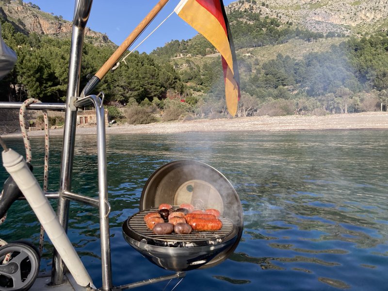
A hanging BBQ grill off the stern rail, sausages and mushrooms cooking over the coals with smoke rising, a German flag flying above and a pine-covered cove with a pebble beach behind

Tinarasia at anchor in a narrow, steep-walled rocky cove with turquoise water

View down a white staircase past modern villas to a small rocky cove with a sailboat anchored offshore

Cap Formentor delivered the season’s signature piece of coastal seamanship, rounding the headland against wind and current that had clear opinions about the matter, on a day that also brought the first meeting with the crew of S/V Greta, a fellow Trans-Ocean e.V. boat out of Potsdam, and Melusina One, with Vicky and Laurent aboard, the only Luxembourg-flagged yacht we’ve ever encountered.
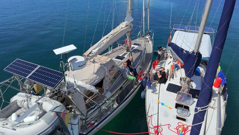
Aerial view of Tinarasia rafted up alongside S/V Greta, with several crew sitting in the cockpits of both boats

Björn, a friend of Anna’s from university, joined the boat in Cala Ratjada, rounding the crew out to five for the crossing to Menorca.
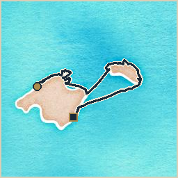
Watercolor-style map of the route from Port de Sóller to Portocolom: a navy track line with a gold circle marking the start and a dark square marking the end

Menorca followed the same pattern of short hops and long anchorages: Cala Pregonda, an anchorage good enough to earn the season’s highest praise: turquoise water, dream-postcard beaches, a scatter of small offshore islets with genuinely strange, almost lunar geology and natural salt pans.
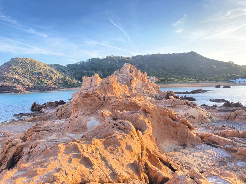
Jagged reddish-orange rock formation rising from turquoise water, with green hills and a white house in the background at low sun

Aerial view of four sailboats anchored in a turquoise bay with a sandy beach, backed by rocky reddish cliffs and green hills

Looking up the mast at a full, colorful asymmetric spinnaker in orange, white, and blue, set against a clear blue sky

Port de Fornells offered a tidy communal harbor, though the town itself felt built purely for tourists, a quick stop rather than a highlight. Mahón’s natural harbor was the real draw: a first night at anchor in Cala Teulera, the only genuinely free spot in a harbor otherwise packed with boats, followed by a move into the port itself for a guest berth at the Club Marítimo de Mahón.
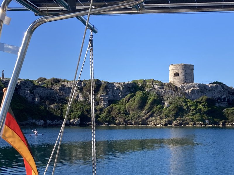
View from the boat's stern rail across the water to a round stone watchtower on a green, rocky headland, with a German flag flying in the foreground

A crossing back toward Mallorca deliberately skipped a planned stop at Cala Ratjada: the forecast, checked carefully in advance, showed barely any wind for most of the route, so rather than break the passage up the crew ran it straight through to Porto Cristo in one long, slow day.
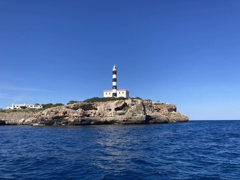
A black-and-white striped lighthouse atop a rocky headland, seen from the water under a clear blue sky

Portocolom marked the end of the family leg of the season: Anna, Jo, Eli, and Björn, aboard since Cala Ratjada, all left the boat, and Tobi continued alone, sailing single-handed for the first time all year.

Solo, then back to two, and the run for home
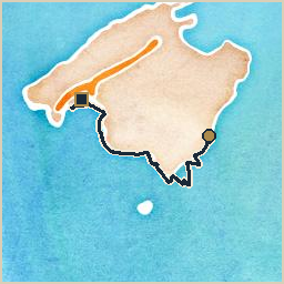
Watercolor-style map of the route from Portocolom to Palma de Mallorca: a navy track line with a gold circle marking the start and a dark square marking the end

The solo stretch down through Cala Mondragó, Platja des Carbó, and around toward Palma stuck to short daylight hops by design, no night watches required. A stopover at the breakwater of Sa Ràpita brought an unexpected reunion with Anja and Denny, first met back in the “other” La Ràpita on the mainland, before the stretch closed with the perennially exciting business of threading into Palma’s enormous harbor and a warm welcome at the Real Club Náutico de Palma, where Anatol came aboard as reinforcement for the run back to the mainland.
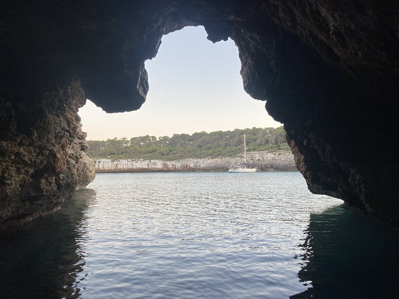
View out through the mouth of a dark sea cave toward a sailboat anchored in a sunlit bay lined with pine trees

The last stretch turned into the most demanding sailing of the return leg. Bad weather forecast for the jump to Ibiza pushed the crew to wait it out at anchor in a forked, cave-pocked bay near Portals Vells, and when the window opened it opened into a long night crossing toward Cala Portinatx, during which a weakening wind briefly had the crew seriously discussing turning back for Port d’Andratx to wait for better conditions, before deciding to press on for Ibiza after all. The arrival, in the dark, meant picking a careful path through a field of unlit mooring buoys.
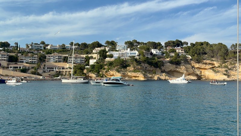
Several boats anchored in a small bay backed by sandy cliffs and white villas among pine trees

A tall sandy-colored cliff with a lone pine tree at its edge, waves breaking at its base, with a village visible in the distance at dusk

View between two pine trees down to a turquoise bay with anchored boats and a sandy beach crowded with sunbathers

A calmer daytime hop the next day covered the short remaining distance to Sant Antoni de Portmany, where the crew found an excellent welcome at Marina Es Nàutic, courtesy of a marinero named Leo. Melusina One turned up again shortly after, pulling into a berth on the very same pontoon.
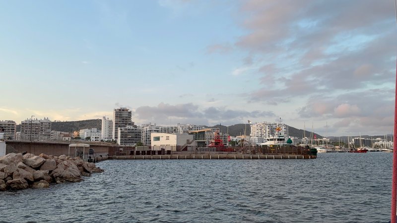
A harbor breakwater with a pile of rocks in the foreground and a dense skyline of white apartment buildings behind, under a pastel evening sky

Watercolor-style map of the route from Palma de Mallorca to Sant Carles de la Ràpita: a navy track line with a gold circle marking the start and a dark square marking the end

The Columbretes

The Columbretes were the season’s most unusual destination by a wide margin: a genuinely remote volcanic archipelago, an overnight passage of roughly seventy nautical miles from Ibiza with freshening wind, noticeable current, and, in the pre-dawn hours, a pod of around twenty dolphins that stayed with the boat for a full twenty minutes, the kind of encounter that makes an otherwise routine overnight watch worth losing sleep over.
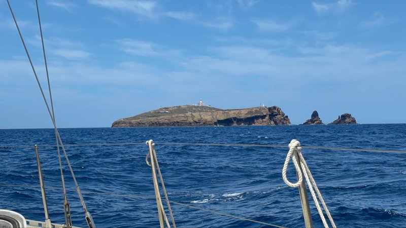
A rocky island with a lighthouse, seen across open water past the boat's bow rail and rigging

The arrival at the islands themselves was briefly unnerving: the crater bay felt like a witches’ cauldron, gusty wind blowing straight in with no safe way to enter, so the crew opted for a mooring outside the rim rather than risk the anchorage that first night. The following day, with conditions settled, they moved into the crater bay proper and called the resident park rangers on VHF, because the volcanic crater turns out to be genuinely inhabited, home to two or three rangers and biologists who double as the islands’ only tour guides, and who had a lot to say about the geology, history, and biology of the place.
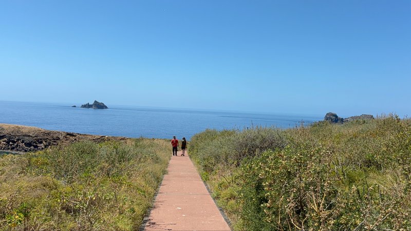
Two people walking along a paved path through scrubby vegetation toward the sea, with small rocky islets visible offshore

Jagged volcanic rock islets rising from the sea at dawn, seen past the boat's bow pulpit

Home again

The final passage retraced, almost exactly, last year’s own crossing from the same waters: fifty nautical miles of open water back to the Spanish mainland, ending at Sant Carles de la Ràpita, less than a mile from the marina where the boat spent the winter. The conditions obliged with one last mixed bag: long and short wave trains, wind that swung between plenty and almost none, and several hours motoring near the end to close the gap.
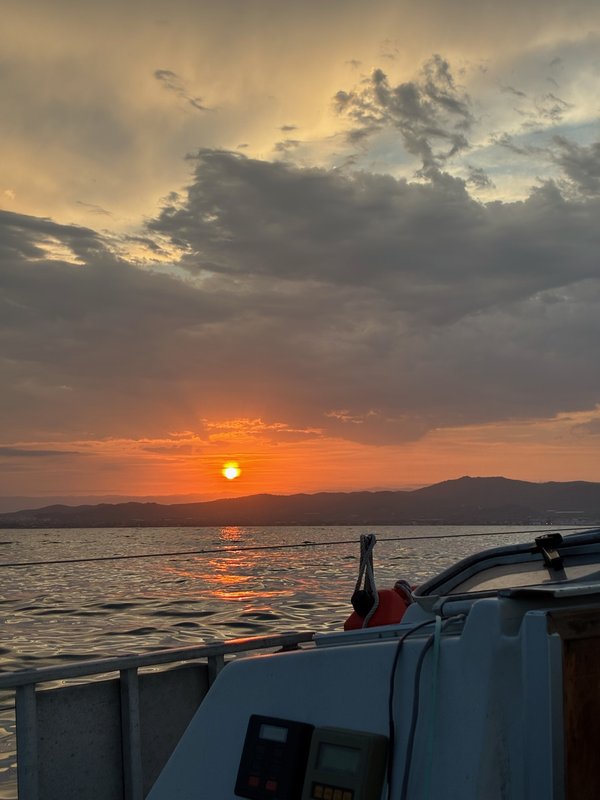
A glowing orange sunset over a mountainous coastline, seen from the boat's cockpit with instruments and railing in the foreground

Tinarasia’s berth for the foreseeable future is at the Club Nàutic de la Ràpita, waiting on the next round of refit work before whatever comes next.
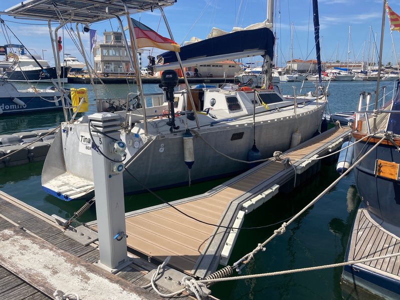
Tinarasia moored stern-to at a marina pontoon, with her name and homeport painted on the transom and other yachts in the background

Across the season, 655.6 nautical miles logged, 529.0 of them under sail, and not a liter of diesel burned anywhere along the way. What stays with the crew, though, isn’t really the mileage: it’s the recurring cast of fellow sailors met once at a dock and then again three weeks and two hundred miles later, the specific logistics of keeping two small children fed, rested, and entertained on a 36-foot boat for weeks at a stretch, and the specific joy of watching a three-year-old learn to spot dolphins before she can properly explain what a dolphin is.